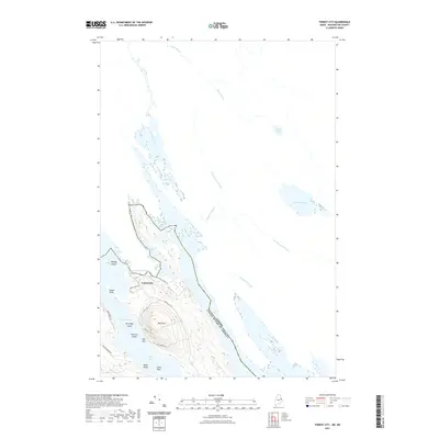
2021 Map of Forest City
USGS Topo · Published 2021About this map
Forest City sits along the international boundary between Maine and New Brunswick, defined here by the winding waters of Mud Lake Stream and Forest City Stream. This 2021 topographic survey captures a landscape dominated by complex waterways and islands, where the Canada and United States Of America border bisects the lake systems. The settlement is centered near Walls Hill, with a network of local roads such as Forest City Rd and Walls Cove Rd providing access to the shoreline and the Spednic Lake Boat Landing Rd.
Find a feature on this map
31 named features on this map. Tap any name to fly to it.
Don’t see what you’re looking for? This feature index may not catch every label — zoom into the map to look around manually.
Map Details
Editions of this 2021 Forest City Map
This is the sole edition of this map. No revisions or reprints were ever made.
Other maps of this area

1940 · Danforth
USGS Topo · 1:62,500

1940 · Amity
USGS Topo · 1:62,500

1940 · Forest
USGS Topo · 1:62,500

1941 · Danforth
USGS Topo · 1:62,500

1941 · Amity
USGS Topo · 1:62,500

1942 · Forest
USGS Topo · 1:62,500

1943 · Danforth
USGS Topo · 1:62,500

1943 · Amity
USGS Topo · 1:62,500

1957 · Fredericton
USGS Topo · 1:250,000
1958 · Danforth
USGS Topo · 1:62,500