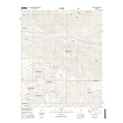
2015 Map of Forest Falls
USGS Topo · Published 2015About this map
Forest Falls and Mountain Home Village occupy the high canyon floors of the San Bernardino National Forest, where the complex drainage of the San Bernardino Mountains converges. This 2015 U.S. Geological Survey topographic study reveals a landscape defined by sharp elevation shifts, from the alpine heights of San Bernardino Peak and Anderson Peak down to the residential expansion of Yucaipa and Banning. The map provides a detailed view of the water system feeding the valleys below, including Monkeyface Falls, Big Falls, and the Little San Gorgonio Cr.
Find a feature on this map
81 named features on this map. Tap any name to fly to it.
Don’t see what you’re looking for? This feature index may not catch every label — zoom into the map to look around manually.
Map Details
Editions of this 2015 Forest Falls Map
This is the sole edition of this map. No revisions or reprints were ever made.
Other maps of this area

1899 · Redlands
USGS Topo · 1:62,500

1901 · Southern California Sheet No. 1
USGS Topo · 1:250,000

1901 · San Jacinto
USGS Topo · 1:125,000

1901 · Redlands
USGS Topo · 1:62,500

1901 · Elsinore
USGS Topo · 1:125,000

1902 · San Gorgonio
USGS Topo · 1:125,000

1904 · Southern California Sheet No. 1
USGS Topo · 1:250,000

1942 · Banning
USGS Topo · 1:62,500

1942 · Perris
USGS Topo · 1:62,500

1943 · Perris
USGS Topo · 1:62,500