
1942 Map of Banning
USGS Topo · Published 1943About this map
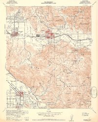
The San Gorgonio Pass serves as the focal point for this wartime survey, showing the critical corridor where the Southern Pacific railroad and major highways, including 60 and 99, navigate the gap between the San Jacinto Mountains and the northern ranges. The map documents the established ranching and resort culture of the early 1940s, featuring the Highland Springs Resort and Gilman Hot Springs, alongside the agricultural hubs of San Jacinto and Hemet. Significant portions of the landscape are dedicated to the Morongo Indian Reservation and Soboba Indian Reservation, which include landmarks such as the St Boniface Indian Sch. In the higher elevations of the San Bernardino National Forest, the map details a network of fire lookouts and guard stations, including the Barton Lookout and Millard Canyon Guard Station, reflecting the importance of forest management and watershed protection in this arid region.
Find a feature on this map
99 named features on this map. Tap any name to fly to it.
Don’t see what you’re looking for? This feature index may not catch every label — zoom into the map to look around manually.
Map Details
Editions of this 1942 Banning Map
2 editions found
Other maps of this area

1899 · Redlands
USGS Topo · 1:62,500

1901 · Southern California Sheet No. 1
USGS Topo · 1:250,000

1901 · San Jacinto
USGS Topo · 1:125,000

1901 · Redlands
USGS Topo · 1:62,500

1901 · Elsinore
USGS Topo · 1:125,000

1902 · San Gorgonio
USGS Topo · 1:125,000

1904 · Southern California Sheet No. 1
USGS Topo · 1:250,000

1940 · Palm Springs
USGS Topo · 1:62,500

1940 · Hemet Reservoir
USGS Topo · 1:62,500

1942 · Hemet Reservoir
USGS Topo · 1:62,500