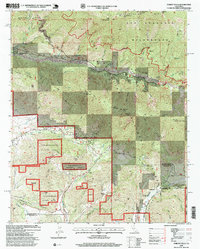
1996 Map of Forest Falls
USGS Topo · Published 1999About this map
Forest Falls and Valley of the Falls sit deep in the Mill Creek Canyon, serving as central points of settlement within the San Bernardino National Forest. This 1990s revision reveals the geographic importance of the Washington Monument (Original Initial Point) on the northern ridge, a primary surveying marker for the region. The landscape is defined by massive elevation shifts between peaks like San Bernardino East Peak and the residential enclaves at Mountain Home Village. South of the Yucaipa Ridge, the map tracks the development of Oak Glen, known for its agricultural history and the Oak Glen Conservation Camp. Infrastructure for water and power management is visible through labels for a Powerhouse, Diversion Dam, and an aqueduct, supporting the communities established along the canyon floors.
Find a feature on this map
44 named features on this map. Tap any name to fly to it.
Don’t see what you’re looking for? This feature index may not catch every label — zoom into the map to look around manually.
Map Details
Editions of this 1996 Forest Falls Map
This is the sole edition of this map. No revisions or reprints were ever made.
Other maps of this area

1899 · Redlands
USGS Topo · 1:62,500

1901 · Southern California Sheet No. 1
USGS Topo · 1:250,000

1901 · San Jacinto
USGS Topo · 1:125,000

1901 · Redlands
USGS Topo · 1:62,500

1901 · Elsinore
USGS Topo · 1:125,000

1902 · San Gorgonio
USGS Topo · 1:125,000

1904 · Southern California Sheet No. 1
USGS Topo · 1:250,000

1942 · Banning
USGS Topo · 1:62,500

1942 · Perris
USGS Topo · 1:62,500

1943 · Perris
USGS Topo · 1:62,500