
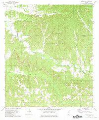
1981 Map of Forest Home
USGS Topo · Published 1981About this map
Forest Home sits at the center of this rural Butler County landscape, serving as a hub for a network of small settlements and country churches during the early 1980s. The area is defined by its deep creek valleys and timbered ridges, with Pine Barren Creek and Barren Creek cutting through the northern half of the quadrangle. Local community life is anchored by numerous houses of worship and burial grounds, such as Zion Rest Ch and its associated Cem, along with Rock Rest Ch and Pine Flat Ch.
Find a feature on this map
31 named features on this map. Tap any name to fly to it.
Don’t see what you’re looking for? This feature index may not catch every label — zoom into the map to look around manually.
Map Details
Editions of this 1981 Forest Home Map
This is the sole edition of this map. No revisions or reprints were ever made.
Other maps of this area

1953 · Andalusia
USGS Topo · 1:250,000

1957 · Andalusia
USGS Topo · 1:250,000

1971 · Greenville West
USGS Topo · 1:24,000

1971 · Fort Dale
USGS Topo · 1:24,000

1971 · Georgiana East
USGS Topo · 1:24,000

1971 · Bethel
USGS Topo · 1:24,000

1971 · Georgiana West
USGS Topo · 1:24,000

1981 · Pine Apple North
USGS Topo · 1:24,000
1981 · Ridgeville
USGS Topo · 1:24,000
1981 · Pine Apple South
USGS Topo · 1:24,000