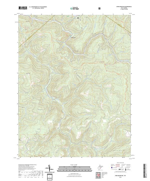
2023 Map of Fork Mountain
USGS Topo · Published 2023About this map
The confluence of the North Fork Cherry River and the South Fork Cherry River defines this landscape in the mountains of Greenbrier County. The small settlement of North Bend sits at a critical junction where the river systems meet, serving as a gateway to the high ridgelines of Fork Mountain and Sugartree Bench Mtn. High elevations are marked by distinctive peaks such as Rockcamp Knob, Mill Knob, and Sugarcamp Knob, while lower-lying areas include the expansive Lost Flat. Genealogists and local historians will find the Nancy Hart Cem in the southwestern corner, a significant landmark in an area otherwise dominated by forest and narrow drainage runs like Tenmile Branch and Briery Run. The presence of the Pocahontas Trail and specialized paths like the Fork Mountain Tri and North Bend Tri highlight the area's history of backcountry navigation and timber-era transit.
Find a feature on this map
46 named features on this map. Tap any name to fly to it.
Don’t see what you’re looking for? This feature index may not catch every label — zoom into the map to look around manually.
Map Details
Editions of this 2023 Fork Mountain Map
This is the sole edition of this map. No revisions or reprints were ever made.
Other maps of this area

1889 · Nicholas
USGS Topo · 1:125,000

1891 · Nicholas
USGS Topo · 1:125,000

1891 · Huntersville
USGS Topo · 1:125,000

1894 · Huntersville
USGS Topo · 1:125,000

1901 · Nicholas
USGS Topo · 1:125,000

1915 · Webster Springs
USGS Topo · 1:48,000

1915 · Cowen
USGS Topo · 1:48,000

1917 · Cowen
USGS Topo · 1:62,500

1918 · Webster Springs
USGS Topo · 1:62,500

1918 · Richwood
USGS Topo · 1:62,500