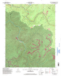
1995 Map of Fork Mountain
USGS Topo · Published 1998About this map
Monongahela National Forest land defines this portion of the West Virginia highlands during the mid-1990s, where high ridges meet extensive resource extraction. The landscape is heavily marked by several Strip Mines and Strip Mine operations that cut across the contours of Falling Spring and the Sugartree Bench Mountain. These industrial scars contrast with the recreational and natural features of the area, such as Summit Lk and the headwaters of the North Fork Cherry River.
Find a feature on this map
52 named features on this map. Tap any name to fly to it.
Don’t see what you’re looking for? This feature index may not catch every label — zoom into the map to look around manually.
Map Details
Editions of this 1995 Fork Mountain Map
This is the sole edition of this map. No revisions or reprints were ever made.
Other maps of this area

1889 · Nicholas
USGS Topo · 1:125,000

1891 · Nicholas
USGS Topo · 1:125,000

1891 · Huntersville
USGS Topo · 1:125,000

1894 · Huntersville
USGS Topo · 1:125,000

1901 · Nicholas
USGS Topo · 1:125,000

1915 · Webster Springs
USGS Topo · 1:48,000

1915 · Cowen
USGS Topo · 1:48,000

1917 · Cowen
USGS Topo · 1:62,500

1918 · Webster Springs
USGS Topo · 1:62,500

1918 · Richwood
USGS Topo · 1:62,500