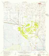
1955 Map of Forked Island
USGS Topo · Published 1956About this map
White Lake and the coastal marshlands of south Louisiana define this mid-century landscape in Vermilion Parish. In the north, the town of Kaplan serves as a hub of activity along the Southern Pacific railroad line, while several private airstrips like Broussard Landing Field and Saltman No 1 Landing Field reflect the regional reliance on light aircraft for navigating the wetlands. The construction of the Intracoastal Waterway cuts a straight path across the terrain, contrasting with the ancient, winding routes of the Pirogue Trail through the marsh. Higher ground is marked by numerous named islands, including Dog Island and Greens Pine Island, which emerge from the expansive wetlands. This survey also records important local landmarks for genealogists, such as St Davids Ch, Hebert Cem, and the community at Forked Island.
Find a feature on this map
58 named features on this map. Tap any name to fly to it.
Don’t see what you’re looking for? This feature index may not catch every label — zoom into the map to look around manually.
Map Details
Editions of this 1955 Forked Island Map
2 editions found
Other maps of this area

1932 · Abbeville SW
USGS Topo · 1:31,680

1932 · Constance Bayou NE
USGS Topo · 1:31,680

1932 · Abbeville NW
USGS Topo · 1:31,680

1945 · Pecan Island NW
USGS Topo · 1:31,680

1945 · Pecan Island NE
USGS Topo · 1:31,680

1946 · Morse
USGS Topo · 1:31,680

1946 · Schooner Bayou SE
USGS Topo · 1:31,680

1946 · Leroy
USGS Topo · 1:31,680

1946 · Schooner Bayou NE
USGS Topo · 1:31,680

1946 · Redfish Point NW
USGS Topo · 1:31,680