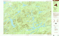
1997 Map of Forked Lake
USGS Topo · Published 1999About this map
Adirondack Park dominates this late-twentieth-century landscape in Hamilton County, revealing a complex network of glacial ponds and mountainous terrain. The map details a wilderness environment punctuated only by remote outposts like Deerland Camp and the southern reach into Arietta. Large water bodies such as Lake Lila and Salmon Lake are connected by numerous smaller features like Hardigan Pond and Mud Pond, illustrating the intricate drainage patterns of the high country.
Find a feature on this map
57 named features on this map. Tap any name to fly to it.
Don’t see what you’re looking for? This feature index may not catch every label — zoom into the map to look around manually.
Map Details
Editions of this 1997 Forked Lake Map
This is the sole edition of this map. No revisions or reprints were ever made.
Other maps of this area

1903 · Big Moose
USGS Topo · 1:62,500

1903 · Raquette Lake
USGS Topo · 1:62,500

1903 · Blue Mountain
USGS Topo · 1:62,500

1904 · Long Lake
USGS Topo · 1:62,500

1907 · Tupper Lake
USGS Topo · 1:62,500

1919 · Cranberry Lake
USGS Topo · 1:62,500

1921 · Cranberry Lake
USGS Topo · 1:62,500

1931 · Cranberry Lake
USGS Topo · 1:62,500

1948 · Ogdensburg
USGS Topo · 1:250,000

1950 · Utica
USGS Topo · 1:250,000