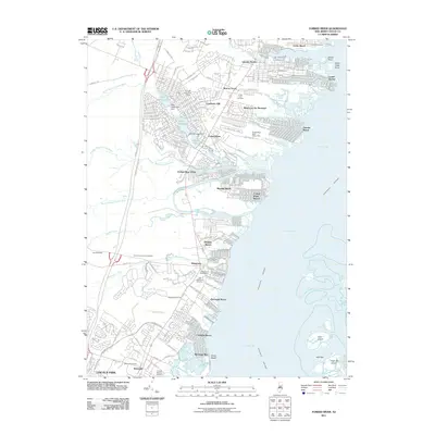
2011 Map of Forked River
USGS Topo · Published 2011About this map
Barnegat Bay defines this coastal landscape, where the Intracoastal Waterway navigates past barrier landmarks like Clam Island and High Bar. The 2011 survey captures the dense residential and maritime expansion of Lanoka Harbor, Forked River, and Waretown. For genealogists, the map identifies several historic burial grounds, including the Old Waretown Cemetery, Good Luck Cemetery, and Friends Meeting Cemetery near the southern border. Inland development is punctuated by water management at the Deer Head Lake Dam and Lake Barnegat Dam, while the northern reaches include the NJ State Game Farm. The intricate network of tidal creeks, such as Stouts Creek and Wrangle Creek, illustrates the deep integration of water and settlement along the Garden State Pkwy corridor.
Find a feature on this map
54 named features on this map. Tap any name to fly to it.
Don’t see what you’re looking for? This feature index may not catch every label — zoom into the map to look around manually.
Map Details
Editions of this 2011 Forked River Map
This is the sole edition of this map. No revisions or reprints were ever made.
Other maps of this area

1884 · Whitings
USGS Topo · 1:62,500

1888 · Barnegat
USGS Topo · 1:62,500

1888 · Little Egg Harbor
USGS Topo · 1:62,500

1888 · Long Beach
USGS Topo · 1:62,500

1888 · Whitings
USGS Topo · 1:62,500

1893 · Little Egg Harbor
USGS Topo · 1:62,500

1893 · Long Beach
USGS Topo · 1:62,500

1893 · Barnegat
USGS Topo · 1:62,500

1898 · Barnegat
USGS Topo · 1:62,500

1919 · Long Beach
USGS Topo · 1:62,500