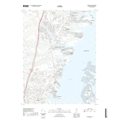
2019 Map of Forked River
USGS Topo · Published 2019About this map
Barnegat Bay and its complex network of tidal creeks define this coastal landscape on the Jersey Shore during the late 2010s. The settlement pattern is dominated by lagoon-front developments and residential fingers reaching into Forked River and Stouts Creek. Significant local history is preserved at the Old Waretown Presbyterian Cem and the Friends Meeting Cem near Barnegat, while the interior remains a mix of protected lands like the NJ State Game Farm and the Ocean County Memorial Park. The map reveals a highly engineered shoreline, where the Intracoastal Waterway passes by High Bar Island and Clam Island, illustrating the modern balance between dense waterfront habitation in areas like Riviera on the Barnegat and the sprawling wetland systems of Oyster Creek.
Find a feature on this map
58 named features on this map. Tap any name to fly to it.
Don’t see what you’re looking for? This feature index may not catch every label — zoom into the map to look around manually.
Map Details
Editions of this 2019 Forked River Map
This is the sole edition of this map. No revisions or reprints were ever made.
Other maps of this area

1884 · Whitings
USGS Topo · 1:62,500

1888 · Barnegat
USGS Topo · 1:62,500

1888 · Little Egg Harbor
USGS Topo · 1:62,500

1888 · Long Beach
USGS Topo · 1:62,500

1888 · Whitings
USGS Topo · 1:62,500

1893 · Little Egg Harbor
USGS Topo · 1:62,500

1893 · Long Beach
USGS Topo · 1:62,500

1893 · Barnegat
USGS Topo · 1:62,500

1898 · Barnegat
USGS Topo · 1:62,500

1919 · Long Beach
USGS Topo · 1:62,500