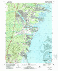
1989 Map of Forked River
USGS Topo · Published 1989About this map
Barnegat Bay dominates the eastern half of this coastal survey, where the intricate network of lagoons and seawalls at Sunrise Beach and Forked River Beach illustrates the intensive late-20th-century residential development of the Jersey Shore. The interior landscape is defined by the three branches of the North Branch, Middle Branch, and South Branch Forked River, which feed into Lake Barnegat and Deer Head Lake.
Find a feature on this map
78 named features on this map. Tap any name to fly to it.
Don’t see what you’re looking for? This feature index may not catch every label — zoom into the map to look around manually.
Map Details
Editions of this 1989 Forked River Map
This is the sole edition of this map. No revisions or reprints were ever made.
Other maps of this area

1884 · Whitings
USGS Topo · 1:62,500

1888 · Barnegat
USGS Topo · 1:62,500

1888 · Little Egg Harbor
USGS Topo · 1:62,500

1888 · Long Beach
USGS Topo · 1:62,500

1888 · Whitings
USGS Topo · 1:62,500

1893 · Little Egg Harbor
USGS Topo · 1:62,500

1893 · Long Beach
USGS Topo · 1:62,500

1893 · Barnegat
USGS Topo · 1:62,500

1898 · Barnegat
USGS Topo · 1:62,500

1919 · Long Beach
USGS Topo · 1:62,500