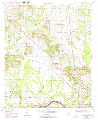
1947 Map of Forkland
USGS Topo · Published 1979About this map
Forkland and the surrounding plantation country of Greene County are documented here through surveys conducted in the 1940s and revised in the late 1970s. The landscape is defined by the winding Tombigbee River and the extensive Hagan Swamp, which dominate the southern and central terrain. This area reflects a deeply rooted rural society where life centered around small family-named landmarks and local institutions like Cook Chapel Sch, Springhill Sch, and Stonewall Taylor Sch. The presence of Derder Landing on the riverbank and the St Louis and San Francisco RR cutting through the center highlights the historical importance of both water and rail transportation for the region's agricultural economy.
Find a feature on this map
47 named features on this map. Tap any name to fly to it.
Don’t see what you’re looking for? This feature index may not catch every label — zoom into the map to look around manually.
Map Details
Editions of this 1947 Forkland Map
3 editions found
Other maps of this area

1927 · Eutaw
USGS Topo · 1:48,000

1929 · Epes
USGS Topo · 1:48,000

1931 · Eutaw
USGS Topo · 1:62,500

1932 · Epes
USGS Topo · 1:62,500

1946 · Demopolis
USGS Topo · 1:24,000

1947 · Demopolis
USGS Topo · 1:24,000

1947 · Mason Bend
USGS Topo · 1:24,000

1947 · Forkland
USGS Topo · 1:24,000

1948 · Mason Bend
USGS Topo · 1:24,000

1948 · Mc Dowell
USGS Topo · 1:24,000