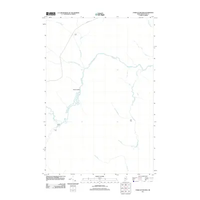
2011 Map of Forks of Machias
USGS Topo · Published 2011About this map
The Machias River winds through this remote stretch of northern Maine, converging with several major tributaries in a landscape dominated by timber and sporting history. The confluence known as the Forks of Machias serves as the geographic anchor for the region, where the river meets McConnell Brook and South Branch McConnell Brook. This 2011 survey documents a network of seasonal outposts and access points essential to the local wilderness economy, including Pingree Camp in the north and V E Lynch Camp to the south. Transport through the dense forest is largely restricted to the water and Pinkham Rd, which provides a lone overland route across the upper terrain. Further east, the drainage basin of Carry Brook and Otter Brook illustrates the intricate hydrography of the Aroostook County woodlands.
Find a feature on this map
13 named features on this map. Tap any name to fly to it.
Don’t see what you’re looking for? This feature index may not catch every label — zoom into the map to look around manually.
Map Details
Editions of this 2011 Forks of Machias Map
This is the sole edition of this map. No revisions or reprints were ever made.
Other maps of this area

1930 · Greenlaw
USGS Topo · 1:48,000

1931 · Ashland
USGS Topo · 1:48,000

1933 · Greenlaw
USGS Topo · 1:62,500

1934 · Ashland
USGS Topo · 1:62,500

1940 · Oxbow
USGS Topo · 1:62,500

1942 · Oxbow
USGS Topo · 1:62,500

1953 · Ashland
USGS Topo · 1:62,500

1954 · Grand Lake Seboeis
USGS Topo · 1:62,500

1954 · Presque Isle
USGS Topo · 1:250,000

1958 · Presque Isle
USGS Topo · 1:250,000