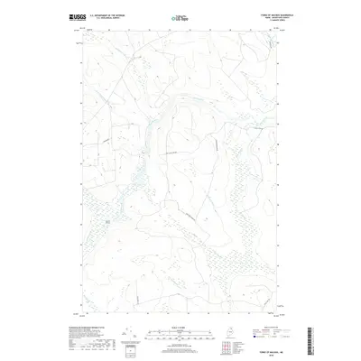
2018 Map of Forks of Machias
USGS Topo · Published 2018About this map
The confluence of the S Br Machias River and the Machias River defines this portion of the Maine north woods, marking the isolated location known as the Forks of Machias. This 2018 survey reveals a landscape almost entirely shaped by the logging industry's infrastructure, where a network of unpaved roads and old trails like Lynchs Tote Rd and New 12 Mile Dam Rd provide the only access to the dense terrain. The hydrography is intricate, with numerous feeder streams including McConnell Brook, Punchard Brook, and Curry Brook carving through the township. The presence of Craig Camp Rd and Vidal Ridge Rd suggests the historical and ongoing importance of seasonal camps and timber management in this sparsely populated region of Aroostook County.
Find a feature on this map
21 named features on this map. Tap any name to fly to it.
Don’t see what you’re looking for? This feature index may not catch every label — zoom into the map to look around manually.
Map Details
Editions of this 2018 Forks of Machias Map
This is the sole edition of this map. No revisions or reprints were ever made.
Other maps of this area

1930 · Greenlaw
USGS Topo · 1:48,000

1931 · Ashland
USGS Topo · 1:48,000

1933 · Greenlaw
USGS Topo · 1:62,500

1934 · Ashland
USGS Topo · 1:62,500

1940 · Oxbow
USGS Topo · 1:62,500

1942 · Oxbow
USGS Topo · 1:62,500

1953 · Ashland
USGS Topo · 1:62,500

1954 · Grand Lake Seboeis
USGS Topo · 1:62,500

1954 · Presque Isle
USGS Topo · 1:250,000

1958 · Presque Isle
USGS Topo · 1:250,000