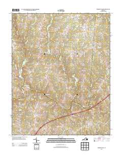
2013 Map of Forksville
USGS Topo · Published 2013About this map
The Meherrin River winds through this rural landscape in Mecklenburg County, serving as a primary geographic anchor for several small historic settlements and crossing points. Named crossroads like Lochleven, Gills Corner, and Bacons Fork reflect the enduring community structures of southern Virginia, while the presence of Stones Mill points to the early local industry that once relied on the region's waterways. The river itself is spanned by several notable structures, including the Union Mill Bridge, Dix Bridge, and the Hawthorne High Bridge, which facilitate travel across a terrain defined by numerous tributaries such as Stony Cr and Aaron Cr. This 2013 survey illustrates the modern road network, including the path of Interstate 85, as it overlays the traditional footprints of 19th and 20th-century family-named routes and landmarks near the community of Forksville.
Find a feature on this map
76 named features on this map. Tap any name to fly to it.
Don’t see what you’re looking for? This feature index may not catch every label — zoom into the map to look around manually.
Map Details
Editions of this 2013 Forksville Map
This is the sole edition of this map. No revisions or reprints were ever made.
Other maps of this area

1918 · Lawrenceville
USGS Topo · 1:62,500

1919 · White Plains
USGS Topo · 1:48,000

1920 · Lawrenceville
USGS Topo · 1:48,000

1920 · White Plains
USGS Topo · 1:62,500

1921 · Lawrenceville
USGS Topo · 1:62,500

1942 · Lawrenceville
USGS Topo · 1:62,500
1951 · Danieltown
USGS Topo · 1:24,000

1953 · Norfolk
USGS Topo · 1:250,000

1953 · Greensboro
USGS Topo · 1:250,000

1954 · Greensboro
USGS Topo · 1:250,000