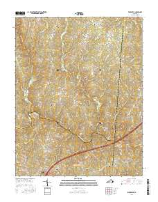
2016 Map of Forksville
USGS Topo · Published 2016About this map
Forksville and South Hill anchor the southern reaches of this landscape where the borders of Mecklenburg, Lunenburg, and Brunswick counties converge. The terrain is defined by the winding course of the Meherrin River, which is spanned by notable crossings including the Hawthorne High Bridge, Union Mill Bridge, and Dix Bridge. This 2016 survey illustrates a largely rural corridor punctuated by small historical hubs such as Bacons Fork and Stones Mill, connected by an intricate network of secondary roads and family-named lanes.
Find a feature on this map
82 named features on this map. Tap any name to fly to it.
Don’t see what you’re looking for? This feature index may not catch every label — zoom into the map to look around manually.
Map Details
Editions of this 2016 Forksville Map
This is the sole edition of this map. No revisions or reprints were ever made.
Other maps of this area

1918 · Lawrenceville
USGS Topo · 1:62,500

1919 · White Plains
USGS Topo · 1:48,000

1920 · Lawrenceville
USGS Topo · 1:48,000

1920 · White Plains
USGS Topo · 1:62,500

1921 · Lawrenceville
USGS Topo · 1:62,500

1942 · Lawrenceville
USGS Topo · 1:62,500
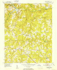
1951 · Danieltown
USGS Topo · 1:24,000

1953 · Norfolk
USGS Topo · 1:250,000

1953 · Greensboro
USGS Topo · 1:250,000

1954 · Greensboro
USGS Topo · 1:250,000