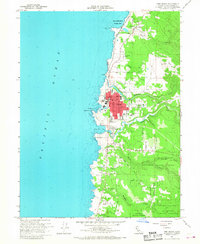
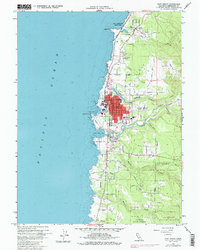
1960 Map of Fort Bragg
USGS Topo · Published 1968About this map
The coastal lumber and fishing hub of Fort Bragg is depicted here during a period of mid-century development. The town's grid is dense with local institutions, including the City Hall, High Sch, and the Post Office, while the California Western RR provides a critical rail link eastward. To the south, the village of Noyo sits at the mouth of the Noyo River, overlooking the protected waters of Noyo Bay.
Find a feature on this map
46 named features on this map. Tap any name to fly to it.
Don’t see what you’re looking for? This feature index may not catch every label — zoom into the map to look around manually.
Map Details
Editions of this 1960 Fort Bragg Map
5 editions found
Other maps of this area

1920 · Glenblair
USGS Topo · 1:62,500

1920 · Fort Bragg
USGS Topo · 1:62,500

1921 · Westport
USGS Topo · 1:62,500

1921 · Branscomb
USGS Topo · 1:62,500

1943 · Glenblair
USGS Topo · 1:62,500

1943 · Fort Bragg
USGS Topo · 1:62,500

1950 · Cape Vizcaino
USGS Topo · 1:62,500

1951 · Cape Vizcaino
USGS Topo · 1:62,500

1951 · Branscomb
USGS Topo · 1:62,500

1957 · Ukiah
USGS Topo · 1:250,000