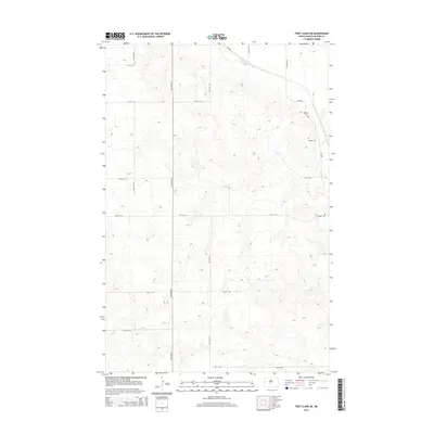
2014 Map of Fort Clark NE
USGS Topo · Published 2014About this map
Small, scattered burial sites dot the rolling terrain of this northern section of Oliver County, following the path of ND-1806. The map captures the agricultural and genealogical layout of the region, anchored by family-named landmarks such as Bagnell Cem and Gaines Cem. These locations, along with Sanger Cem further south, serve as primary historical markers in an area defined by its section-line road network. The landscape is structured by a grid of local thoroughfares including 28th Ave SW and 16th St SW, which trace the high ground and coulees of the Missouri River plateau. This topographical survey highlights the enduring rural character of the county, where infrastructure is minimal and the legacy of early landholders is preserved primarily through these small cemeteries and the established road grid.
Find a feature on this map
16 named features on this map. Tap any name to fly to it.
Don’t see what you’re looking for? This feature index may not catch every label — zoom into the map to look around manually.
Map Details
Editions of this 2014 Fort Clark NE Map
This is the sole edition of this map. No revisions or reprints were ever made.
Other maps of this area

1949 · Turtle Creek
USGS Topo · 1:62,500

1949 · Washburn
USGS Topo · 1:62,500

1950 · Wilton
USGS Topo · 1:62,500

1954 · McClusky
USGS Topo · 1:250,000

1958 · McClusky
USGS Topo · 1:250,000

1961 · Turtle Creek SW
USGS Topo · 1:24,000

1961 · Washburn
USGS Topo · 1:24,000

1966 · Price
USGS Topo · 1:24,000
1966 · Sanger
USGS Topo · 1:24,000

1967 · Washburn SW
USGS Topo · 1:24,000