Old Maps of Oliver County, North Dakota
Explore 183 old maps of Oliver County, spanning from 1907 to today. These high-resolution historic maps reveal how streets, neighborhoods, landmarks, and natural features evolved over time — perfect for genealogy, metal detecting, research, and local history exploration.
What you can do with these maps:
- See how Oliver County changed over time: Compare historical maps to modern-day views to trace roads, homesites, rail lines & more.
- View detailed metadata: Each map includes creators, publishers, year, scale, and archive source.
- Overlay maps with satellite & LiDAR: Visualize the past alongside modern tools to explore terrain & human change.
- Trusted historical sources: Maps sourced from the USGS, Library of Congress, and other archives.
- Access maps your way: View online, download high-res files, or order prints for personal or research use.
Start exploring old maps of Oliver County to uncover forgotten places, hidden landmarks, and the deep history beneath your feet.
Oliver County, ND maps
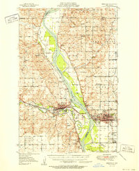
(183)- 1907 Map of Bismarck
 1907 Bismarck1907 Print · USGSThe Missouri River corridor at the turn of the century shows North Dakota's capital and rail hubs in their formative years. Researchers can trace early land divisions and transport routes like the Fort Yates Stage Road and landmarks such as Fort Lincoln or St Anthony.2 unique versions available
 - 1948 Map of Stanton, 1962 Print
 1948 Stanton1962 Print · USGSMid-century Mercer and McLean Counties are shown during the transformation of the Missouri River valley. Genealogists can locate family-named landmarks like Williams Sch, the Stanton Cem, and the historic Ft Clark (Site) near the Knife River confluence.
 - 1949 Map of Stanton
 1949 Stanton1949 Print · USGSThe Missouri River valley stands at the brink of transformation in the late 1940s as the massive Garrison Dam project begins near Riverdale. Researchers can trace the original river course and numerous family-named schools like Baisch Sch and Matton Sch alongside the Northern Pacific rail line.
 - 1949 Map of Turtle Creek
 1949 Turtle Creek1949 Print · USGSMcLean County townships are shown here in the late 1940s, highlighting a landscape of rural schools and prairie homesteads. Researchers can locate specific sites like Fairview Ch, Veeder Cem, and numerous schoolhouses including Satterlund Sch No 1.2 unique versions available
 - 1949 Map of Washburn
 1949 Washburn1949 Print · USGSMcLean County is captured here in the late 1940s as the river economy met the railroad age along the Missouri River. Family historians can trace numerous rural school sites like Weller School No 1 and the path of the Lewis and Clark Trail.2 unique versions available
 - 1950 Map of Wilton
 1950 Wilton1950 Print · USGSThe Missouri River breaks and upland prairies of McLean and Burleigh counties are mapped here at mid-century. Genealogists can locate family names via numerous rural landmarks, from Painted Woods Ch and Wing Cem to several local schoolhouses like School No 2.2 unique versions available
 - 1951 Map of Bismarck
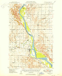
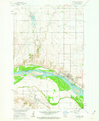
 1951 Bismarck1951 Print · USGSBismarck and Mandan sit at the heart of the Missouri River valley at mid-century, just as the post-war era began to reshape the North Dakota capital. Genealogists and local historians can trace legacy landmarks like St Marys Cem, the Great Plains Experiment Station, and numerous rural schoolhouses such as Sunny Sch.
 - 1954 Map of Bismarck, 1967 Print
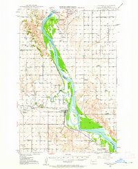
 1954 Bismarck1967 Print · USGSBismarck and the Missouri River basin are shown in the mid-1960s as the Oahe Reservoir reshaped the valley. Genealogists can trace family-named landmarks like Dog Tooth Buttes and small prairie settlements such as Fort Yates, Selfridge, and Brisbane.2 unique versions available
 - 1954 Map of McClusky, 1968 Print
 1954 McClusky1968 Print · USGSCentral North Dakota was undergoing a profound transformation in the fifties as the newly formed Lake Sakakawea reshaped the Missouri River valley. Genealogists and historians can trace rail-town development along the Soo Line and locate historic markers like Garrison Dam or the Lewis and Clark Trail.3 unique versions available
 - 1958 Map of Bismarck
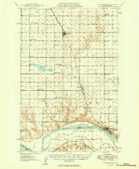
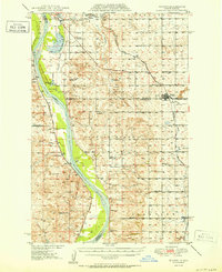
 1958 Bismarck1958 Print · USGSCentral North Dakota in the late fifties is defined by the Missouri River and the sprawling Standing Rock Indian Reservation. Genealogists and historians can trace rail-line outposts like Sedalia Siding or explore local landmarks like Saint Anthony and Fort Lincoln State Park/Museum.
 - 1958 Map of McClusky
 1958 McClusky1958 Print · USGSCentral North Dakota was undergoing a profound change in the late fifties as the Garrison Reservoir filled behind its massive new dam. Trace the early layout of Riverdale, the Lewis and Clark Trail, and the vanishing rail stops of the Northern Pacific.
 - 1961 Map of Turtle Creek SW, 1963 Print
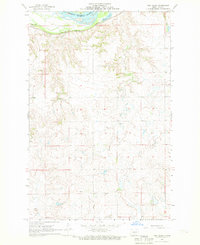
 1961 Turtle Creek SW1963 Print · USGSMcLean and Oliver counties meet along the Missouri River in the early sixties, where the prairie landscape is shaped by wandering coulees. Genealogists and local historians can locate rural landmarks like Koenig Sch No 3, Satterlund Sch No 2, and the Lost Lake National Wildlife Refuge.
 - 1961 Map of Washburn, 1963 Print
 1961 Washburn1963 Print · USGSWashburn and the Missouri River bottoms are captured here in the early sixties as the regional rail and river economy evolved. Genealogists and local historians can trace family roots through the Riverview Cem, Hensler, and the Buffalo Lake Sch No 2.3 unique versions available
 - 1962 Map of Harmon, 1964 Print
 1962 Harmon1964 Print · USGSThe Missouri River valley north of Bismarck comes alive in the early sixties, showing a landscape of riverside settlements and active rail lines. Genealogists and historians can trace the Northern Pacific tracks through Harmon or locate Square Butte School No 1 and the Double Ditch Indian Village.2 unique versions available
 - 1966 Map of Price, 1967 Print
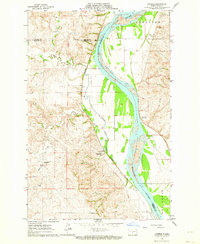
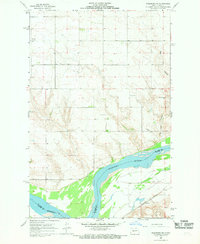
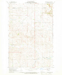
 1966 Price1967 Print · USGSThe Missouri River valley in Oliver County during the mid-1960s shows a landscape of river-oriented settlement and rail transport. Genealogists and historians can trace the foundations of Price, locate Price Sch, and explore landmarks like Square Buttes.2 unique versions available
 - 1966 Map of Sanger, 1967 Print
 1966 Sanger1967 Print · USGSThe Missouri River bottoms north of Bismarck come alive in the mid-1960s, showing a landscape defined by shifting water and steam-era rail lines. Researchers can trace the river's influence from the settlement of Sanger to the wetlands of the National Wildlife Refuge and Wildwood Lake.
 - 1967 Map of Washburn SW, 1968 Print
 1967 Washburn SW1968 Print · USGSAlong the Missouri River in the mid-1960s, the landscape of McLean and Oliver Counties reveals a blend of prairie agriculture and industry. Genealogists and historians can trace family ties at Birka Ch Cem or locate the site of the Black Diamond Mine near the Coal Lake Coulee.2 unique versions available
 - 1967 Map of Stanton SE, 1969 Print
 1967 Stanton SE1969 Print · USGSThe Missouri River valley in the late 1960s serves as a hub of both frontier legacy and industrial utility. Genealogists and historians can locate family landmarks like Basto Cem alongside major sites including Fort Mandan Historic Site and the Northern Pacific rail line.2 unique versions available
 - 1968 Map of Hannover NE, 1969 Print
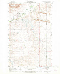
 1968 Hannover NE1969 Print · USGSThe Missouri River borderlands of Oliver and Mercer Counties are captured here in the late sixties during a period of industrial growth. Local researchers can trace the historic Fort Clark Historic Site, find family names at Bagley Cem, and locate the old Strip Mine and Alderin settlement.2 unique versions available
 - 1968 Map of Red Butte, 1969 Print
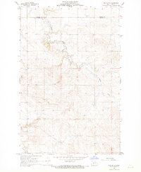 1968 Red Butte1969 Print · USGSThe prairie border between Oliver and Mercer counties is captured here in the late sixties, showing a landscape of section lines and winding creek beds. Genealogists and local historians can locate Nisbet Cem, Red Butte Cem, and the prominent landmark of Red Butte.
 - 1968 Map of Fort Clark, 1969 Print
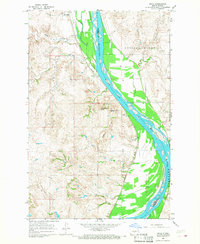
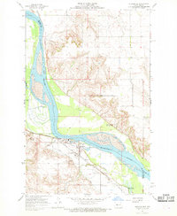
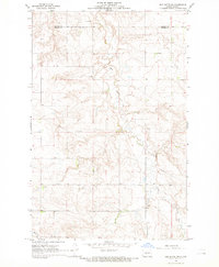
 1968 Fort Clark1969 Print · USGSThe Missouri River breaks across the northern plains of Oliver County in the late sixties, where the railroad meets the river valley. Trace the early transportation routes of the Northern Pacific near Fort Clark and the shores of Mandan Lake.
 - 1968 Map of Medicine Butte NE, 1969 Print
 1968 Medicine Butte NE1969 Print · USGSNorth Dakota's energy and water infrastructure take center stage in the 1960s as mining and rail expand across the Mercer and Oliver county line. Trace local history at Rose Hill Cem, the massive Strip Mine works, and the site of the Proposed Beulah Dam.2 unique versions available
 - 1968 Map of Red Butte NW, 1969 Print
 1968 Red Butte NW1969 Print · USGSOliver and Mercer Counties in the late sixties reveal a landscape of winding coulees and high plains agriculture. Trace local family history at Rhein Cem or study the era's infrastructure through the prominent Pipeline and rural Flowing Well sites.2 unique versions available
 - 1968 Map of Fort Clark NE, 1969 Print
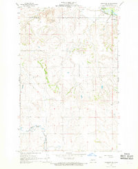
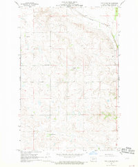 1968 Fort Clark NE1969 Print · USGSThe ranching country of Oliver County is captured here in the late sixties, showing a landscape defined by rail and remote homesteads. Genealogists and historians can trace local families through Sanger Cem and rural schools like Manley Sch No 3.
 - 1968 Map of Hannover NW, 1969 Print
 1968 Hannover NW1969 Print · USGSThe border of Oliver and Mercer counties comes into focus in the late 1960s, showing a prairie landscape of section-line farms and creeks. Researchers can trace the footprints of rural education and community at Pleasant Valley Sch No 1 and a local Cemetery along Kinneman Creek.
Showing maps 1-25 of 183
Top cities of Oliver County
Frequently asked questions
- What are the different types of historical maps available for Oliver County?
- What is the oldest map of Oliver County?
- Where can I purchase historical maps of Oliver County for my home or office?
- Where can I download high-res historical maps of Oliver County?
- Are there historical topographic maps available for Oliver County?
- Is there historical aerial imagery available for Oliver County?
- Where are historical maps of Oliver County sourced from?