1970s Maps of Oliver County, North Dakota
Explore 17 historic maps of Oliver County from the 1970s. These maps offer a rare glimpse into what life looked like during the 1970s — showing old roads, neighborhoods, homes, and landmarks that have changed or disappeared over time.
Whether you're researching your family's past, planning a metal detecting trip, or studying how Oliver County's landscape evolved across the 1970s, these high-resolution maps are a powerful tool for exploring the history of this region.
- Focus on a specific era: All maps on this page are from the 1970s, giving you a focused view of this time period.
- See what’s changed: Compare century-old streets, trails, and buildings to today's modern landscape using overlays and satellite layers.
- Research with precision: Use these maps for genealogy, historical research, land use analysis, or educational projects.
- View, download, or print: Maps are fully viewable online in high resolution, and can be downloaded or printed for your own records.
Start exploring Oliver County's history through authentic maps from the 1970s. This is your window into the past.
Oliver County, ND maps
(17)- 1970 Map of Bluegrass, 1972 Print
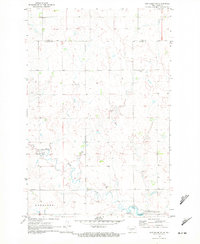
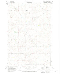
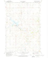
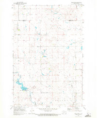 1970 Bluegrass1972 Print · USGSNorth Dakota's prairie landscape comes into focus during the early 1970s, showcasing a rural world of small settlements and emerging conservation areas. Genealogists and historians can trace the local drainage of Sweet Briar Creek, the development of Storm Creek Lake, and the remote outposts of Bluegrass and Briar.
 - 1970 Map of New Salem NW, 1972 Print
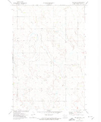
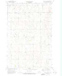
 1970 New Salem NW1972 Print · USGSWestern North Dakota prairie life in the early seventies centered on rural settlements and the land's hidden resources. Genealogists and researchers can locate the site of Youngtown, trace the winding Sweet Briar Creek, or identify workings at the local Strip Mine.
 - 1970 Map of Hailstone Butte, 1972 Print
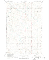
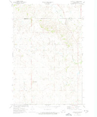
 1970 Hailstone Butte1972 Print · USGSMorton and Oliver counties are documented here in the early seventies, showing a landscape of high plains agriculture and scattered prairie landmarks. Genealogists can locate rural burial sites like St Markus Cem and Bluegrass Cem or trace the drainages of Hailstone Creek.
 - 1970 Map of Glen Ullin NE, 1972 Print
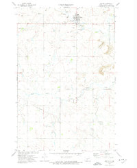
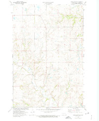
 1970 Glen Ullin NE1972 Print · USGSMorton County in the early seventies shows a landscape shaped by rural industry and prairie waterways. Researchers can trace the courses of Coyote Creek and Haymarsh Creek or locate early industrial sites like the Gravel Pits.
 - 1970 Map of New Salem NE, 1972 Print
 1970 New Salem NE1972 Print · USGSMorton and Oliver counties are documented here in the early seventies, just as the local landscape was adapting to new conservation and water projects. Researchers can trace rural landmarks like Bremen Cem, the Lignite Pit, and the newly formed Sweet Briar Lake.
 - 1972 Map of Red Butte SW, 1974 Print
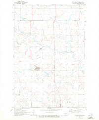
 1972 Red Butte SW1974 Print · USGSOliver County agricultural lands are captured here during the early seventies, showing a quiet landscape of prairie drainages and section-line roads. Genealogists can locate family sites near St Benedict Cem or trace the paths of Brush Creek and Coyote Creek.
 - 1972 Map of Medicine Butte SE, 1974 Print
 1972 Medicine Butte SE1974 Print · USGSThe high plains of Mercer and Oliver Counties were still a land of remote homesteads and prairie creeks in the early seventies. Genealogists and local historians can locate family landmarks like the New Gluecksthal Cem, Unruh Cem, and Beaver Creek.
 - 1972 Map of Center, 1974 Print
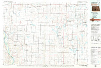
 1972 Center1974 Print · USGSThe Oliver County seat in the early 1970s shows a community at the edge of active coal and scoria extraction. Genealogists and researchers can trace local landmarks like St Pauls Cem, the course of Hagel Creek, and the extensive network of Strip Mines.2 unique versions available
 - 1972 Map of Otter Creek, 1974 Print
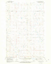
 1972 Otter Creek1974 Print · USGSOliver County agriculture and rural life are preserved here in the early 1970s, showcasing a landscape of township roads and creek valleys. Genealogists and local historians can locate Otter Creek Cem and old country schools like Spring Brook Sch.
 - 1972 Map of Crown Butte NW, 1974 Print
 1972 Crown Butte NW1974 Print · USGSMorton and Oliver counties are captured in the early seventies, showcasing a rural landscape defined by prairie agriculture and resource extraction. Researchers can trace land use through the Lignite Pit, Gravel Pits, and local landmarks like St Vincent Ch.
 - 1972 Map of Crown Butte, 1974 Print
 1972 Crown Butte1974 Print · USGSThe rural borderlands between Morton and Oliver counties are captured here in the early seventies, showing a landscape defined by rolling prairie and modern utility. Researchers can trace the path of Square Butte Creek, locate the local Strip Mine, and identify the prominent Crown Butte landmark.
 - 1972 Map of Fort Clark SE, 1975 Print
 1972 Fort Clark SE1975 Print · USGSOliver County lands appear in their late-century rural form, shaped by the waters of Square Butte Creek and Sherk Creek. Researchers can trace old property lines across the township boundaries or locate the Yucca Cem and the landmark Ring Hill.
 - 1972 Map of Nelson Lake, 1975 Print
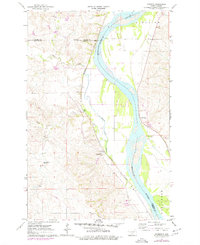
 1972 Nelson Lake1975 Print · USGSOliver County entered a period of heavy industrialization in the early seventies, dominated by coal mining and power generation. Researchers can trace the massive Milton R Young Powerplant and the surrounding Strip Mine operations that reshaped the banks of Nelson Lake.2 unique versions available
 - 1972 Map of Hannover, 1975 Print
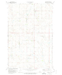 1972 Hannover1975 Print · USGSOliver County ranching and farming lands are documented here during the early 1970s. Researchers can locate the community of Hannover and trace local landmarks like Square Butte and a remote Mine situated along the high prairie.
 - 1976 Map of Harmon, 1977 Print
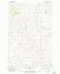
 1976 Harmon1977 Print · USGSThe Missouri River valley north of Bismarck reveals a landscape of ancient settlements and early rail corridors in the mid-seventies. Trace the historic Double Ditch Indian Village and find remote rural landmarks like Square Butte School No 1 and Harmon.
 - 1979 Map of Bismarck, 1980 Print
 1979 Bismarck1980 Print · USGSBismarck and Mandan sit at the heart of this late-century North Dakota survey, where the Missouri River flows past historic frontier outposts. Trace the old Soo Line rail corridors or locate family landmarks near St Anthony, Fort Rice, and Custer Flats.
 - 1979 Map of McClusky, 1980 Print
 1979 McClusky1980 Print · USGSSheridan and Burleigh Counties are shown here during the late twentieth century, when the McClusky Canal and the Burlington Northern railroad shaped the rural economy. Researchers can locate historic town centers like Pickardville and Arena alongside numerous game management areas and local landmarks like Haystack Butte.
End of results
Showing maps 1-17 of 17
Top cities of Oliver County
Frequently asked questions
- What are the different types of historical maps available for Oliver County?
- What is the oldest map of Oliver County?
- Where can I purchase historical maps of Oliver County for my home or office?
- Where can I download high-res historical maps of Oliver County?
- Are there historical topographic maps available for Oliver County?
- Is there historical aerial imagery available for Oliver County?
- Where are historical maps of Oliver County sourced from?