
1970 Map of Bluegrass
USGS Topo · Published 1972About this map
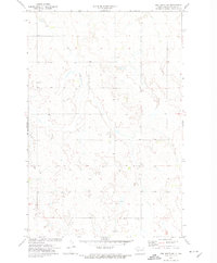
Bluegrass and the small settlement of Briar anchor this 1970 snapshot of the rolling North Dakota landscape near the border of Oliver and Morton counties. The map reveals a rural economy shaped by both land and water, most notably at the Storm Creek State Game Management Area where Storm Creek Lake is held back by a designated earthen dam. The presence of a Lignite Pit in the northern section of the sheet points to the region's coal-mining heritage, while several marked wells indicate a reliance on underground water sources for agricultural and domestic use. The prairie terrain is deeply dissected by a network of drainage systems including Sweet Briar Creek, Hailstone Creek, and Muskrat Creek, which converge to define the local geography and property boundaries during this era of post-war development.
Find a feature on this map
10 named features on this map. Tap any name to fly to it.
Don’t see what you’re looking for? This feature index may not catch every label — zoom into the map to look around manually.
Map Details
Editions of this 1970 Bluegrass Map
This is the sole edition of this map. No revisions or reprints were ever made.
Other maps of this area

1954 · Bismarck
USGS Topo · 1:250,000

1954 · McClusky
USGS Topo · 1:250,000

1958 · Bismarck
USGS Topo · 1:250,000

1958 · McClusky
USGS Topo · 1:250,000

1960 · North Almont
USGS Topo · 1:24,000

1960 · Dengate
USGS Topo · 1:24,000

1960 · New Salem
USGS Topo · 1:24,000

1970 · New Salem NW
USGS Topo · 1:24,000

1970 · Hailstone Butte
USGS Topo · 1:24,000
1972 · Red Butte SW
USGS Topo · 1:24,000