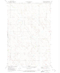
1972 Map of Red Butte SW
USGS Topo · Published 1974About this map
Brush Creek winds through the rolling uplands of Oliver County, carving a drainage pattern that defines this rural landscape in the early 1970s. This survey, conducted by the Geological Survey in cooperation with the State of North Dakota Water Commission, captures a sparsely settled agricultural region where section lines dictate the road network. Notable for local history and genealogy are the small community landmarks that persist in the open country, including St Benedict Cem in the northwest and Buchmann Cem in the southeast corner. The terrain is further shaped by the headwaters of Coyote Creek and Otter Creek, illustrating the complex water table management crucial to North Dakota's prairie economy. The map provides a precise record of farmstead locations and unimproved roads as they existed before modern land-use changes.
Find a feature on this map
7 named features on this map. Tap any name to fly to it.
Don’t see what you’re looking for? This feature index may not catch every label — zoom into the map to look around manually.
Map Details
Editions of this 1972 Red Butte SW Map
This is the sole edition of this map. No revisions or reprints were ever made.
Other maps of this area

1954 · Bismarck
USGS Topo · 1:250,000

1954 · McClusky
USGS Topo · 1:250,000

1958 · Bismarck
USGS Topo · 1:250,000

1958 · McClusky
USGS Topo · 1:250,000

1968 · Red Butte
USGS Topo · 1:24,000

1968 · Medicine Butte NE
USGS Topo · 1:24,000

1968 · Red Butte NW
USGS Topo · 1:24,000

1970 · Bluegrass
USGS Topo · 1:24,000

1970 · Hailstone Butte
USGS Topo · 1:24,000

1970 · Glen Ullin NE
USGS Topo · 1:24,000