
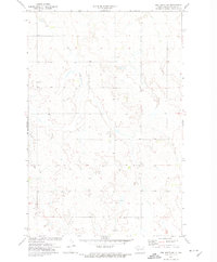
1970 Map of Hailstone Butte
USGS Topo · Published 1972About this map
The rolling prairies along the Oliver and Morton County border are defined by seasonal drainages and small rural landmarks in this 1970 field-checked survey. Hailstone Butte stands as a prominent elevation point, overlooking the winding paths of Hailstone Creek and Wilson Creek. The landscape is largely agricultural, marked by numerous springs and windmills that support the scattered homesteads. Evidence of early community life is preserved through local burial sites such as St Markus Cem and Bluegrass Cem, which remain as core historical identifiers for this sparsely populated region. In the southern portion of the map, the label Curlew marks the terrain near the rail corridor, while several Gravel Pit locations indicate the local extraction industry used for road maintenance across the county line.
Find a feature on this map
10 named features on this map. Tap any name to fly to it.
Don’t see what you’re looking for? This feature index may not catch every label — zoom into the map to look around manually.
Map Details
Editions of this 1970 Hailstone Butte Map
This is the sole edition of this map. No revisions or reprints were ever made.
Other maps of this area

1954 · Bismarck
USGS Topo · 1:250,000

1954 · McClusky
USGS Topo · 1:250,000

1958 · Bismarck
USGS Topo · 1:250,000

1958 · McClusky
USGS Topo · 1:250,000

1960 · North Almont
USGS Topo · 1:24,000

1960 · Dengate
USGS Topo · 1:24,000

1960 · Glen Ullin
USGS Topo · 1:24,000

1970 · Bluegrass
USGS Topo · 1:24,000

1970 · Glen Ullin NE
USGS Topo · 1:24,000
1972 · Red Butte SW
USGS Topo · 1:24,000