
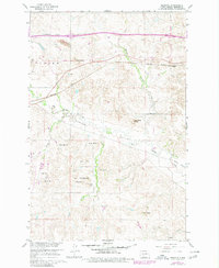
1960 Map of Dengate
USGS Topo · Published 1961About this map
Curlew Valley dominates this 1960 Morton County landscape, where the Northern Pacific railroad tracks bisect the rolling terrain of western North Dakota. The small settlement of Dengate serves as a focal point along the rail line, while the surrounding countryside is dotted with evidence of early rural education and industry. Notable landmarks like School No 4 and Monson Sch represent the local school districts of the era, while a Strip Mine and another unnamed Mine indicate the extraction of coal or other resources from the hills. The intricate drainage of Big Muddy Creek and its tributaries, including Wilson Creek and Kurtz Creek, winds through a topography defined by prominent landforms such as Twin Buttes, Jackrabbit Butte, and Porcupine Hill. An Old Railroad Grade in the southeast suggests a shifting transportation network as the region developed.
Find a feature on this map
29 named features on this map. Tap any name to fly to it.
Don’t see what you’re looking for? This feature index may not catch every label — zoom into the map to look around manually.
Map Details
Editions of this 1960 Dengate Map
2 editions found
Other maps of this area

1938 · Heart Butte
USGS Topo · 1:48,000

1944 · Heart Butte
USGS Topo · 1:62,500

1954 · Bismarck
USGS Topo · 1:250,000

1958 · Bismarck
USGS Topo · 1:250,000

1960 · North Almont
USGS Topo · 1:24,000

1960 · Glen Ullin
USGS Topo · 1:24,000

1960 · Heart Butte
USGS Topo · 1:24,000

1970 · Bluegrass
USGS Topo · 1:24,000

1970 · Hailstone Butte
USGS Topo · 1:24,000

1970 · Glen Ullin NE
USGS Topo · 1:24,000