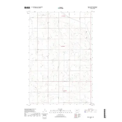
2017 Map of Fort Clark NE
USGS Topo · Published 2017About this map
Oliver County terrain is meticulously documented in this section of central North Dakota, where the landscape is defined by the Public Land Survey System grid and undulating contours. Several family and community burial sites provide vital touchstones for genealogical research, including Bagnell Cem and Gaines Cem located in the northeastern section of the map. Further south along the eastern margin lies Sanger Cem, anchoring a region of scattered rural homesteads. The transport network is strictly oriented to the section lines, with routes like Hensler Rd and a series of numbered roads such as 12th St SW and 20th St SW carving through the prairie. This 2017 survey reflects the enduring agricultural layout of the region, where the township divisions of t144n r82w and t143n r82w organize the modern landscape much as they did during initial settlement.
Find a feature on this map
19 named features on this map. Tap any name to fly to it.
Don’t see what you’re looking for? This feature index may not catch every label — zoom into the map to look around manually.
Map Details
Editions of this 2017 Fort Clark NE Map
This is the sole edition of this map. No revisions or reprints were ever made.
Other maps of this area

1949 · Turtle Creek
USGS Topo · 1:62,500

1949 · Washburn
USGS Topo · 1:62,500

1950 · Wilton
USGS Topo · 1:62,500

1954 · McClusky
USGS Topo · 1:250,000

1958 · McClusky
USGS Topo · 1:250,000

1961 · Turtle Creek SW
USGS Topo · 1:24,000

1961 · Washburn
USGS Topo · 1:24,000

1966 · Price
USGS Topo · 1:24,000
1966 · Sanger
USGS Topo · 1:24,000

1967 · Washburn SW
USGS Topo · 1:24,000