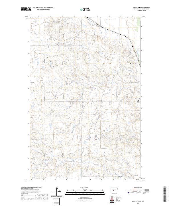
2024 Map of Fort Clark NE
USGS Topo · Published 2024About this map
Small rural burial grounds like Bagnell Cem and Gaines Cem dot the uplands of Oliver County, marking the long-standing family foundations of this prairie landscape. The area is defined by a strictly surveyed grid of section lines and gravel paths, including Hensler Rd and 25th Ave SW, which facilitate movement across the rolling terrain between the Missouri River valley and the interior plains. Farther south, near the edge of the survey, lies Sanger Cem, providing essential markers for genealogists and local historians tracing the settlement patterns of central North Dakota. The map illustrates the enduring agrarian character of the region, where land divisions remain largely unchanged from the early township and range system established in the late 19th century.
Find a feature on this map
19 named features on this map. Tap any name to fly to it.
Don’t see what you’re looking for? This feature index may not catch every label — zoom into the map to look around manually.
Map Details
Editions of this 2024 Fort Clark NE Map
This is the sole edition of this map. No revisions or reprints were ever made.
Other maps of this area

1949 · Turtle Creek
USGS Topo · 1:62,500

1949 · Washburn
USGS Topo · 1:62,500

1950 · Wilton
USGS Topo · 1:62,500

1954 · McClusky
USGS Topo · 1:250,000

1958 · McClusky
USGS Topo · 1:250,000

1961 · Turtle Creek SW
USGS Topo · 1:24,000

1961 · Washburn
USGS Topo · 1:24,000

1966 · Price
USGS Topo · 1:24,000
1966 · Sanger
USGS Topo · 1:24,000

1967 · Washburn SW
USGS Topo · 1:24,000