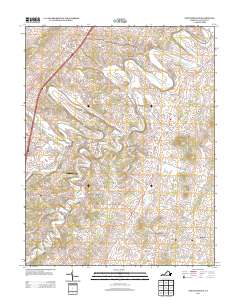
2013 Map of Fort Defiance
USGS Topo · Published 2013About this map
Middle River carves a winding path through the heart of this landscape, anchoring several small settlements including Knightly, Damtown, and Piedmont. The area reflects a predominantly agricultural character, punctuated by established locales like New Hope and Hermitage that serve as local hubs for the surrounding farmsteads. To the northwest, Fort Defiance stands along the historic Lee Hwy corridor, while the central portion is defined by the winding course of Christians Cr.
Find a feature on this map
112 named features on this map. Tap any name to fly to it.
Don’t see what you’re looking for? This feature index may not catch every label — zoom into the map to look around manually.
Map Details
Editions of this 2013 Fort Defiance Map
This is the sole edition of this map. No revisions or reprints were ever made.
Other maps of this area

1892 · Harrisonburg
USGS Topo · 1:125,000

1894 · Staunton
USGS Topo · 1:125,000

1934 · Waynesboro
USGS Topo · 1:48,000

1939 · Waynesboro
USGS Topo · 1:62,500

1941 · Harrisonburg
USGS Topo · 1:62,500

1943 · Harrisonburg
USGS Topo · 1:62,500

1944 · Parnassus
USGS Topo · 1:62,500

1944 · Staunton
USGS Topo · 1:62,500

1947 · Staunton
USGS Topo · 1:62,500

1947 · Parnassus
USGS Topo · 1:62,500