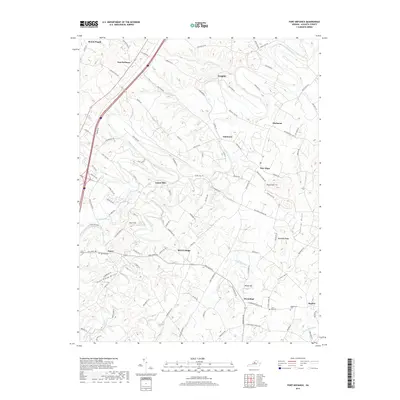
2019 Map of Fort Defiance
USGS Topo · Published 2019About this map
Fort Defiance and the surrounding rural communities of Augusta County are documented in this 2019 survey, showcasing a landscape defined by the winding course of the Middle River and numerous local tributaries. The map reveals a dense network of country roads such as Fort Defiance Rd and Battlefield Rd, connecting long-standing settlements like Knightly, Piedmont, and New Hope. Genealogists will find particular value in the clearly marked burial grounds, including Belmont Cem, Saint Paul Cem, and Hildebrand Cem. The terrain is characterized by distinctive elevations like Round Hill and Kennedy Ridge, while names like Poor Farm Draft and Coleytown Run offer insight into the local geographic nomenclature. The settlement pattern remains largely dispersed, reflecting the area's agricultural roots as small clusters like Hermitage and Madrid sit at various crossroads.
Find a feature on this map
102 named features on this map. Tap any name to fly to it.
Don’t see what you’re looking for? This feature index may not catch every label — zoom into the map to look around manually.
Map Details
Editions of this 2019 Fort Defiance Map
This is the sole edition of this map. No revisions or reprints were ever made.
Other maps of this area

1892 · Harrisonburg
USGS Topo · 1:125,000

1894 · Staunton
USGS Topo · 1:125,000

1934 · Waynesboro
USGS Topo · 1:48,000

1939 · Waynesboro
USGS Topo · 1:62,500

1941 · Harrisonburg
USGS Topo · 1:62,500

1943 · Harrisonburg
USGS Topo · 1:62,500

1944 · Parnassus
USGS Topo · 1:62,500

1944 · Staunton
USGS Topo · 1:62,500

1947 · Staunton
USGS Topo · 1:62,500

1947 · Parnassus
USGS Topo · 1:62,500