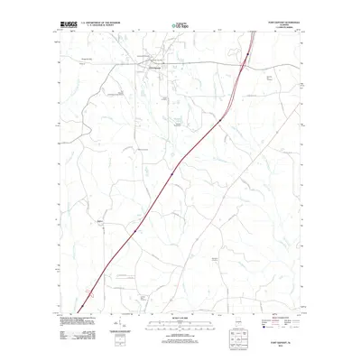
2011 Map of Fort Deposit
USGS Topo · Published 2011About this map
Fort Deposit serves as the central hub of this Lowndes County landscape, showing a established grid of streets including Coleman St, Hale St, and Bishop St near the Fort Deposit Post Office. The surrounding rural character is defined by several burial grounds vital for genealogical research, such as Myrtlewood Cemetery north of town and Antioch East Cemetery situated near the headwaters of Fourmile Mill Branch. The geography is shaped by a dense network of waterways like Pigeon Creek and Halls Creek, which are crossed by an array of local routes including Wagon Wheel Rd and Old Stage Rd. To the southwest, the small settlement of Searcy marks a secondary point of activity, while the presence of the Fort Deposit-Lowndes County Airport and the Golson Pond Dam at Golson Lake illustrate the 21st-century infrastructure supporting this Alabama community.
Find a feature on this map
60 named features on this map. Tap any name to fly to it.
Don’t see what you’re looking for? This feature index may not catch every label — zoom into the map to look around manually.
Map Details
Editions of this 2011 Fort Deposit Map
This is the sole edition of this map. No revisions or reprints were ever made.
Other maps of this area

1953 · Montgomery
USGS Topo · 1:250,000

1953 · Andalusia
USGS Topo · 1:250,000

1956 · Montgomery
USGS Topo · 1:250,000

1957 · Montgomery
USGS Topo · 1:250,000

1957 · Andalusia
USGS Topo · 1:250,000

1957 · Letohatchee
USGS Topo · 1:62,500

1971 · Greenville West
USGS Topo · 1:24,000

1971 · Fort Deposit
USGS Topo · 1:24,000

1971 · Honoraville
USGS Topo · 1:24,000

1971 · Fort Dale
USGS Topo · 1:24,000