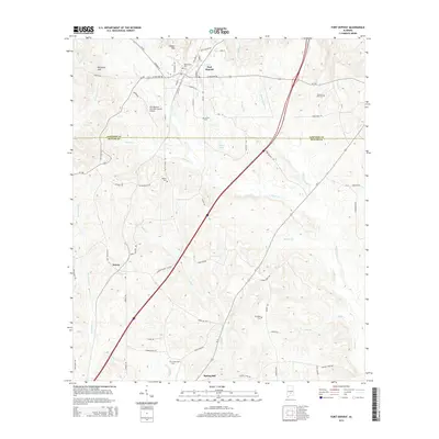
2014 Map of Fort Deposit
USGS Topo · Published 2014About this map
Fort Deposit stands as the primary hub in this portion of south-central Alabama, where the historical road network converges near the border of Lowndes and Butler counties. The landscape is characterized by a high concentration of rural burial grounds, including Myrtlewood Cem, Jordan Cem, and Moriah Cem, which serve as vital touchstones for family history in the region. To the south, the settlements of Searcy and Spring Hill sit among the headwaters of numerous creeks like Pigeon Cr and Halls Cr, indicating a legacy of early agricultural development and water-powered industry. The modernization of the corridor is evident through the placement of the Fort Deposit-Lowndes County Airport and the dominant path of the interstate, which cuts through the older topography of Gilmer Hills and Barganier Hill.
Find a feature on this map
70 named features on this map. Tap any name to fly to it.
Don’t see what you’re looking for? This feature index may not catch every label — zoom into the map to look around manually.
Map Details
Editions of this 2014 Fort Deposit Map
This is the sole edition of this map. No revisions or reprints were ever made.
Other maps of this area

1953 · Montgomery
USGS Topo · 1:250,000

1953 · Andalusia
USGS Topo · 1:250,000

1956 · Montgomery
USGS Topo · 1:250,000

1957 · Montgomery
USGS Topo · 1:250,000

1957 · Andalusia
USGS Topo · 1:250,000

1957 · Letohatchee
USGS Topo · 1:62,500

1971 · Greenville West
USGS Topo · 1:24,000

1971 · Fort Deposit
USGS Topo · 1:24,000

1971 · Honoraville
USGS Topo · 1:24,000

1971 · Fort Dale
USGS Topo · 1:24,000