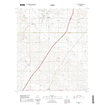
2020 Map of Fort Deposit
USGS Topo · Published 2020About this map
Fort Deposit stands as a central hub on the southern edge of the Lowndes-Butler county line, where the landscape transitions from the elevations of Barganier Hill and the Gilmer Hills into the bottomlands of the Pigeon Creek Swamp. This modern survey reveals a highly developed network of local roads and state routes, including Federal Rd and Old Fort Rd, which connect the town to outlying communities like Searcy and Spring Hill.
Find a feature on this map
81 named features on this map. Tap any name to fly to it.
Don’t see what you’re looking for? This feature index may not catch every label — zoom into the map to look around manually.
Map Details
Editions of this 2020 Fort Deposit Map
This is the sole edition of this map. No revisions or reprints were ever made.
Other maps of this area

1953 · Montgomery
USGS Topo · 1:250,000

1953 · Andalusia
USGS Topo · 1:250,000

1956 · Montgomery
USGS Topo · 1:250,000

1957 · Montgomery
USGS Topo · 1:250,000

1957 · Andalusia
USGS Topo · 1:250,000

1957 · Letohatchee
USGS Topo · 1:62,500

1971 · Greenville West
USGS Topo · 1:24,000

1971 · Fort Deposit
USGS Topo · 1:24,000

1971 · Honoraville
USGS Topo · 1:24,000

1971 · Fort Dale
USGS Topo · 1:24,000