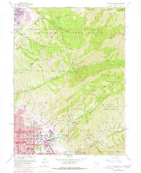
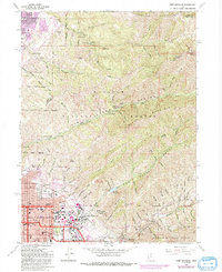
1963 Map of Fort Douglas
USGS Topo · Published 1978About this map
Fort Douglas and the University of Utah anchor the eastern edge of Salt Lake City, where the urban grid meets the steep slopes of the Wasatch National Forest. This era of development shows the city's expansion into the foothills, including the purple-tinted additions of University Village and the Veterans Hospital. The map documents a complex landscape of public and institutional land use, from the sprawling City Cemetery and its neighboring Catholic Cem and Jewish Cem, to the protected lands of the Fort Douglas Military Reservation.
Find a feature on this map
89 named features on this map. Tap any name to fly to it.
Don’t see what you’re looking for? This feature index may not catch every label — zoom into the map to look around manually.
Map Details
Editions of this 1963 Fort Douglas Map
5 editions found
Other maps of this area

1885 · Salt Lake
USGS Topo · 1:250,000

1925 · Ft. Douglas
USGS Topo · 1:125,000

1928 · Ft. Douglas
USGS Topo · 1:125,000

1950 · Fort Douglas
USGS Topo · 1:24,000

1951 · Fort Douglas
USGS Topo · 1:24,000

1951 · Salt Lake City South
USGS Topo · 1:24,000

1951 · Salt Lake City North
USGS Topo · 1:24,000

1952 · Sugar House
USGS Topo · 1:24,000

1952 · Farmington
USGS Topo · 1:24,000

1952 · Bountiful Peak
USGS Topo · 1:24,000