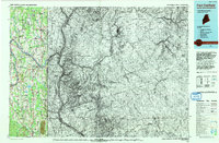
1993 Map of Fort Fairfield
USGS Topo · Published 1993About this map
The Aroostook River winds through this international borderland, anchoring the major settlements of Caribou and Fort Fairfield. In the north, the massive footprint of Loring Air Force Base dominates the landscape near Limestone, while the Loran Coast Guard Sta and U S Customs stations reflect the strategic cross-border nature of this Maine-New Brunswick corridor. The rural character of the county is defined by its agricultural crossroads, including numerous family-named landmarks like Cote Corner and Morris Corner. Transport and industry are evident in the path of the Bangor and Aroostook Railroad, which connected timber and agricultural hubs such as Phair and Easton Station. In the south, the prominent rise of Mars Hill stands above the smaller townships of Blaine and Westfield, marking the transition into the dense woodland and waterway networks of Victoria Co across the Canadian line.
Find a feature on this map
59 named features on this map. Tap any name to fly to it.
Don’t see what you’re looking for? This feature index may not catch every label — zoom into the map to look around manually.
Map Details
Editions of this 1993 Fort Fairfield Map
This is the sole edition of this map. No revisions or reprints were ever made.
Other maps of this area

1921 · Van Buren
USGS Topo · 1:250,000

1927 · Stockholm
USGS Topo · 1:48,000

1929 · Caribou
USGS Topo · 1:48,000

1930 · Fort Fairfield
USGS Topo · 1:48,000

1931 · Van Buren
USGS Topo · 1:48,000

1931 · Stockholm
USGS Topo · 1:62,500

1932 · Caribou
USGS Topo · 1:62,500

1933 · Fort Fairfield
USGS Topo · 1:62,500

1934 · Bridgewater
USGS Topo · 1:48,000

1934 · Van Buren
USGS Topo · 1:62,500