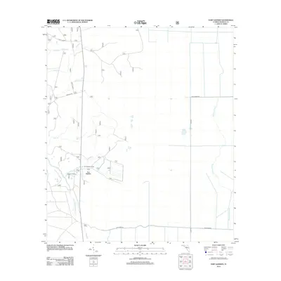
2012 Map of Fort Gadsden
USGS Topo · Published 2012About this map
Fort Gadsden stands as the central landmark in this 2012 survey of southern Franklin County, occupying a strategic bend in the river system. The landscape is defined by an intricate network of waterways, including Whiskey George Cr to the east and the winding S Prong Fort Gadsden Cr which meets with Fort Gadsden Cr. Evidence of localized infrastructure and historical transport is visible through features like Missouri Landing and the Fort Gadsden Bridge.
Find a feature on this map
18 named features on this map. Tap any name to fly to it.
Don’t see what you’re looking for? This feature index may not catch every label — zoom into the map to look around manually.
Map Details
Editions of this 2012 Fort Gadsden Map
This is the sole edition of this map. No revisions or reprints were ever made.
Other maps of this area

1943 · Jackson River
USGS Topo · 1:24,000

1944 · Green Point
USGS Topo · 1:31,680

1944 · Forbes Island
USGS Topo · 1:24,000

1945 · Forbes Island
USGS Topo · 1:31,680

1945 · Kennedy Creek
USGS Topo · 1:31,680

1945 · Tates Hell Swamp
USGS Topo · 1:31,680

1945 · Beverly
USGS Topo · 1:31,680

1945 · Jackson River
USGS Topo · 1:31,680

1945 · Fort Gadsden
USGS Topo · 1:31,680

1946 · Sumatra
USGS Topo · 1:31,680