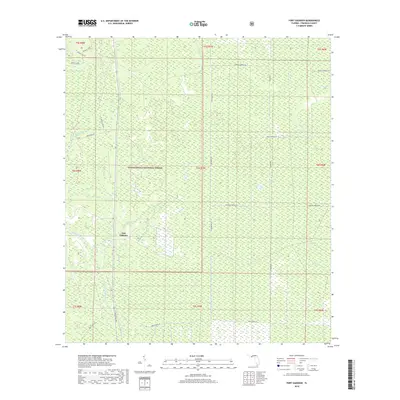
2018 Map of Fort Gadsden
USGS Topo · Published 2018About this map
Fort Gadsden occupies a central role in this portion of the Apalachicola National Forest, where the swampy lowlands of Franklin County are defined by a complex network of creeks and branches. The settlement pattern here is sparse, dictated by the wet terrain and the dominance of the protected forest lands. Water features like Wright Lake, Van Horn Bay, and Evans Lake punctuate the landscape, while numerous drainage ways such as Fort Gadsden Creek, Whiskey George Cr, and Brickyard Cr snake through the timberland.
Find a feature on this map
30 named features on this map. Tap any name to fly to it.
Don’t see what you’re looking for? This feature index may not catch every label — zoom into the map to look around manually.
Map Details
Editions of this 2018 Fort Gadsden Map
This is the sole edition of this map. No revisions or reprints were ever made.
Other maps of this area

1943 · Jackson River
USGS Topo · 1:24,000

1944 · Green Point
USGS Topo · 1:31,680

1944 · Forbes Island
USGS Topo · 1:24,000

1945 · Forbes Island
USGS Topo · 1:31,680

1945 · Kennedy Creek
USGS Topo · 1:31,680

1945 · Tates Hell Swamp
USGS Topo · 1:31,680

1945 · Beverly
USGS Topo · 1:31,680

1945 · Jackson River
USGS Topo · 1:31,680

1945 · Fort Gadsden
USGS Topo · 1:31,680

1946 · Sumatra
USGS Topo · 1:31,680