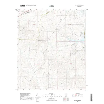
2018 Map of Fort Gaines NW
USGS Topo · Published 2018About this map
Scottsboro Crossroads and Screamer anchor this rural landscape in eastern Henry County, where the terrain transitions from the upland heights of the Baker Hill Cuesta toward the waters of the Walter F George Reservoir. The settlement pattern is defined by historic local gathering points, evidenced by a high density of country burial grounds such as Chester Chapel Cem, Mount Olive Cem, and the Old Judson Cem.
Find a feature on this map
80 named features on this map. Tap any name to fly to it.
Don’t see what you’re looking for? This feature index may not catch every label — zoom into the map to look around manually.
Map Details
Editions of this 2018 Fort Gaines NW Map
This is the sole edition of this map. No revisions or reprints were ever made.
Other maps of this area

1953 · Dothan
USGS Topo · 1:250,000

1954 · Dothan
USGS Topo · 1:250,000

1955 · Dothan
USGS Topo · 1:250,000

1967 · Hatcher
USGS Topo · 1:24,000

1968 · Baker Hill
USGS Topo · 1:24,000

1968 · Eufaula South
USGS Topo · 1:24,000

1969 · Abbeville West
USGS Topo · 1:24,000

1969 · Fort Gaines
USGS Topo · 1:24,000

1969 · Fort Gaines NW
USGS Topo · 1:24,000

1969 · Fort Gaines NE
USGS Topo · 1:24,000