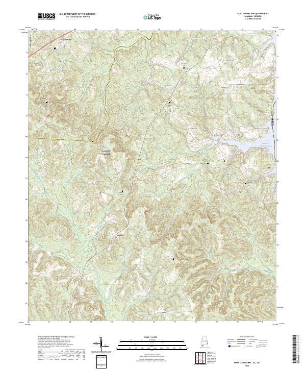
2024 Map of Fort Gaines NW
USGS Topo · Published 2024About this map
Abbie Creek winds through the heart of this landscape, carving a valley between the Baker Hill Cuesta and the shores of the Walter F George Reservoir. The map documents a dispersed rural settlement pattern defined by crossroads and country churches, with communities like Scottsboro Crossroads and Screamer serving as local hubs. Along the state line with Georgia, the shoreline is dotted with small inlets and residential branches, including Otho Branch near the settlement of Otho. For researchers of local family history, the density of burial sites provides significant value. The map identifies several generational markers including Old Judson Cem, Pleasant Hill Cem, and Mount Olive Cem, often situated near historic congregations like Chester Chapel Cem or along early county routes such as Co RD 52 and Henry Co 92.
Find a feature on this map
44 named features on this map. Tap any name to fly to it.
Don’t see what you’re looking for? This feature index may not catch every label — zoom into the map to look around manually.
Map Details
Editions of this 2024 Fort Gaines NW Map
This is the sole edition of this map. No revisions or reprints were ever made.
Other maps of this area

1953 · Dothan
USGS Topo · 1:250,000

1954 · Dothan
USGS Topo · 1:250,000

1955 · Dothan
USGS Topo · 1:250,000

1967 · Hatcher
USGS Topo · 1:24,000

1968 · Baker Hill
USGS Topo · 1:24,000

1968 · Eufaula South
USGS Topo · 1:24,000

1969 · Abbeville West
USGS Topo · 1:24,000

1969 · Fort Gaines
USGS Topo · 1:24,000

1969 · Fort Gaines NW
USGS Topo · 1:24,000

1969 · Fort Gaines NE
USGS Topo · 1:24,000