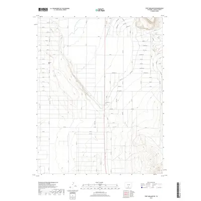
2019 Map of Fort Garland SW
USGS Topo · Published 2019About this map
The Basaltic Hills dominate the western landscape of this Costilla County region, where the high desert terrain is shaped by a complex network of historic water management features. The irrigation infrastructure is particularly prominent, featuring the Trinchera Canal, the Highline Canal, and the Sangre de Cristo Ditch Number 3. These waterways represent the vital lifelines of the San Luis Valley, supporting agriculture in an otherwise arid environment.
Find a feature on this map
96 named features on this map. Tap any name to fly to it.
Don’t see what you’re looking for? This feature index may not catch every label — zoom into the map to look around manually.
Map Details
Editions of this 2019 Fort Garland SW Map
This is the sole edition of this map. No revisions or reprints were ever made.
Other maps of this area

1954 · Trinidad
USGS Topo · 1:250,000

1955 · Trinidad
USGS Topo · 1:250,000

1958 · Trinidad
USGS Topo · 1:250,000

1959 · Trinidad
USGS Topo · 1:250,000

1965 · Blanca
USGS Topo · 1:24,000

1965 · Blanca SE
USGS Topo · 1:24,000

1967 · San Luis
USGS Topo · 1:24,000

1967 · Fort Garland SW
USGS Topo · 1:24,000

1967 · Ojito Peak
USGS Topo · 1:24,000
1967 · Trinchera Ranch
USGS Topo · 1:24,000