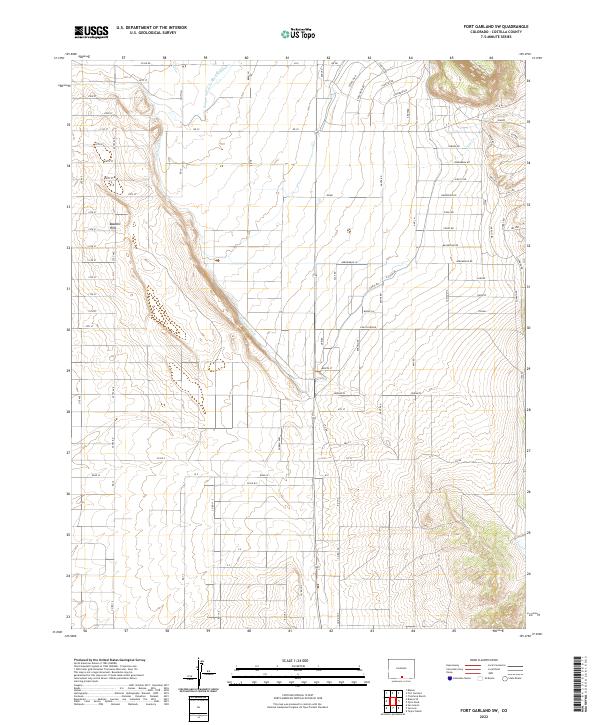
2022 Map of Fort Garland SW
USGS Topo · Published 2022About this map
The Basaltic Hills rise above a strictly gridded landscape in this portion of Costilla County, defined by a complex network of irrigation infrastructure essential to high-desert agriculture. The engineered water system includes the Sangre de Cristo Ditch Number 3, Trinchera Canal, and the extensive Highline Canal, which follow the subtle contours of the San Luis Valley. This rigid road system, including named thoroughfares like Ute Ave, Aztec Ave, and Smith Ln, reflects a highly organized rural settlement pattern where property lines and access roads are dictated by the underlying section-line surveys. Natural drainage is represented by Ojito Cr, which cuts through the eastern portion of the quadrangle. Along the eastern edge, local naming conventions appear in streets like Juarez, La Mancha, and Barcelona, hinting at the cultural heritage of the region.
Find a feature on this map
90 named features on this map. Tap any name to fly to it.
Don’t see what you’re looking for? This feature index may not catch every label — zoom into the map to look around manually.
Map Details
Editions of this 2022 Fort Garland SW Map
This is the sole edition of this map. No revisions or reprints were ever made.
Other maps of this area

1954 · Trinidad
USGS Topo · 1:250,000

1955 · Trinidad
USGS Topo · 1:250,000

1958 · Trinidad
USGS Topo · 1:250,000

1959 · Trinidad
USGS Topo · 1:250,000

1965 · Blanca
USGS Topo · 1:24,000

1965 · Blanca SE
USGS Topo · 1:24,000

1967 · San Luis
USGS Topo · 1:24,000

1967 · Fort Garland SW
USGS Topo · 1:24,000

1967 · Ojito Peak
USGS Topo · 1:24,000
1967 · Trinchera Ranch
USGS Topo · 1:24,000