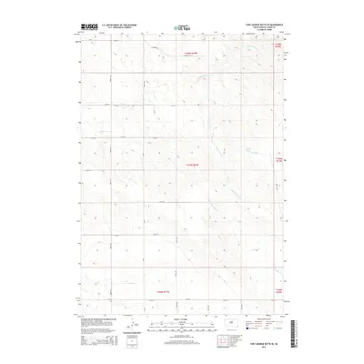
2015 Map of Fort George Butte SE
USGS Topo · Published 2015About this map
Dipping Tank Cr and its various tributaries carve a complex drainage pattern across this Lyman County landscape, defining the local topography. This 2015 survey by the U.S. Geological Survey illustrates a region of South Dakota where the section-line road grid remains the primary human imprint on the land. Notable routes such as Cypress Rd and Cr-22 follow these geometric boundaries, connecting dispersed ranching or agricultural operations. The map documents the headwaters of Grouse Cr and S Fork Cedar Cr, offering a clear look at the relationship between the prairie drainage systems and the established township and range system. This specialized data, including Nail Cr in the southwest, provides essential context for understanding land division and water resources in the central part of the state during the early 21st century.
Find a feature on this map
19 named features on this map. Tap any name to fly to it.
Don’t see what you’re looking for? This feature index may not catch every label — zoom into the map to look around manually.
Map Details
Editions of this 2015 Fort George Butte SE Map
This is the sole edition of this map. No revisions or reprints were ever made.
Other maps of this area

1953 · Huron
USGS Topo · 1:250,000

1954 · Pierre
USGS Topo · 1:250,000

1954 · Huron
USGS Topo · 1:250,000

1955 · Martin
USGS Topo · 1:250,000

1955 · Mitchell
USGS Topo · 1:250,000

1958 · Pierre
USGS Topo · 1:250,000

1958 · Martin
USGS Topo · 1:250,000

1959 · Mitchell
USGS Topo · 1:250,000

1966 · Ft. George Butte SE
USGS Topo · 1:24,000

1966 · Joe Creek NW
USGS Topo · 1:24,000