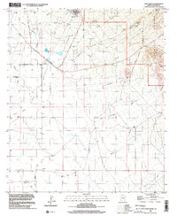
1996 Map of Fort Grant
USGS Topo · Published 2002About this map
Fort Grant (State Prison) dominates this landscape at the base of the Graham Mountains, marking a transition from institutional use to the open cattle ranching of the Arizona high desert. The 1996 imagery update reveals the structured layout of the prison facility and its associated landing strips, set against the historical context of the Fort Grant Military Reservation Boundary. To the south and west, the settlement of Bonita serves as a local hub near Grant Creek, surrounded by established family holdings like Mills Ranch and Estes Ranch.
Find a feature on this map
26 named features on this map. Tap any name to fly to it.
Don’t see what you’re looking for? This feature index may not catch every label — zoom into the map to look around manually.
Map Details
Editions of this 1996 Fort Grant Map
This is the sole edition of this map. No revisions or reprints were ever made.
Other maps of this area

1922 · Willcox
USGS Topo · 1:125,000

1940 · Sierra Bonita Ranch
USGS Topo · 1:62,500

1942 · Sierra Bonita Ranch
USGS Topo · 1:62,500

1942 · Mt. Graham
USGS Topo · 1:62,500

1943 · Willcox
USGS Topo · 1:62,500

1943 · Sierra Bonita Ranch
USGS Topo · 1:62,500

1943 · Winchester Mts.
USGS Topo · 1:62,500

1945 · Mt. Graham
USGS Topo · 1:62,500

1945 · Winchester Mts.
USGS Topo · 1:62,500

1954 · Silver City
USGS Topo · 1:250,000