
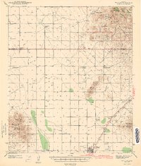
1943 Map of Willcox
USGS Topo · Published 1943About this map
Willcox serves as the central hub of this mid-century desert landscape, situated at the junction of the Southern Pacific railroad and a network of arterial ranch roads. The map reveals a transition between the high desert floor and the surrounding ranges, including the Dos Cabezas Mountains and Winchester Mountains. Significant for local historians and genealogists, the survey identifies numerous family holdings such as the Monzingo Ranch, Brookerson Ranch, and Fischer Ranch, illustrating the cattle-driven economy of the era. The presence of the Stewart Sch and the Airport on the outskirts of town indicates a community balancing traditional pastoral life with modern infrastructure. To the northeast, the Coronado National Forest boundary marks a shift in land use, where rugged terrain like Greasewood Mtn overlooks several seasonal water sources including Frog Spr and Malay Spr.
Find a feature on this map
43 named features on this map. Tap any name to fly to it.
Don’t see what you’re looking for? This feature index may not catch every label — zoom into the map to look around manually.
Map Details
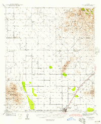
Editions of this 1943 Willcox Map
3 editions found
Other maps of this area

1922 · Willcox
USGS Topo · 1:125,000

1940 · Sierra Bonita Ranch
USGS Topo · 1:62,500

1942 · Sierra Bonita Ranch
USGS Topo · 1:62,500

1942 · Mt. Graham
USGS Topo · 1:62,500

1943 · Dos Cabezas
USGS Topo · 1:62,500

1943 · Cochise
USGS Topo · 1:62,500

1943 · Dragoon
USGS Topo · 1:62,500

1943 · Sierra Bonita Ranch
USGS Topo · 1:62,500

1943 · Winchester Mts.
USGS Topo · 1:62,500

1944 · Fisher Hills
USGS Topo · 1:62,500