Loading...
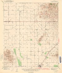
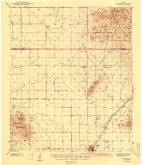
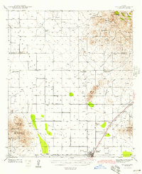
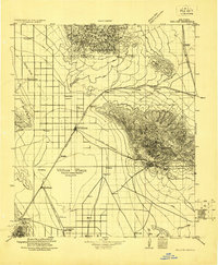
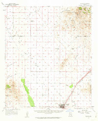
Loading map...1943 Map of Willcox
USGS Topo · Published 1943About this map
The high-desert ranching and railroad hub of Willcox serves as the focal point of this 1940s survey. Situated in a broad valley between the Winchester Mountains and the Dos Cabezas Mountains, the area is defined by the vital Southern Pacific rail line and a network of arterial roads like Fort Grant Road and Sunset Road. The map documents a landscape of established family holdings, including the Brookerson Ranch, Monzingo Ranch, and Gillman Ranch, each often centered around a well or tank essential for livestock in this arid terrain.
Find a feature on this map
48 named features on this map. Tap any name to fly to it.
Don’t see what you’re looking for? This feature index may not catch every label — zoom into the map to look around manually.
Map Details
Date Portrayed1943
Date Published1943
PublisherU.S. Geological Survey
Map TypeTopographic
Scale1:62,500
Physical Dimensions16.85 x 19.84 inches
Editions of this 1943 Willcox Map
3 editions found
Historical Maps of Willcox Through Time
4 maps found
Featured Locations
Source Details
SourceU.S. Geological Survey
CopyrightPublic Domain