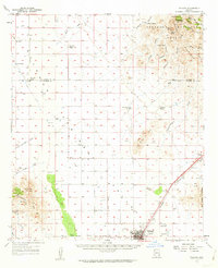
1958 Map of Willcox
USGS Topo · Published 1962About this map
The Southern Pacific railroad corridor anchors this survey of the Arizona desert, centering on the growing community of Willcox. Situated at the junction of the Cascabel Road and Fort Grant Road, the town displays mid-century development including a High Sch, a Golf Course, and a Drive-in Theater. Beyond the town site, the landscape transitions from the basin's Dry Lakes to the timbered heights of the Coronado National Forest and the Pinaleno Mountains. The surrounding valley is defined by established cattle operations such as the Brookreson Ranch and Monzingo Ranch, while the northeast corner rises toward Grease-wood Mtn. Strategic geography is evident at Railroad Pass, where transportation routes navigate the gap between the Dos Cabezas Mountains and the Winchester Mts.
Find a feature on this map
61 named features on this map. Tap any name to fly to it.
Don’t see what you’re looking for? This feature index may not catch every label — zoom into the map to look around manually.
Map Details
Editions of this 1958 Willcox Map
3 editions found

Other maps of this area

1922 · Willcox
USGS Topo · 1:125,000

1940 · Sierra Bonita Ranch
USGS Topo · 1:62,500

1942 · Sierra Bonita Ranch
USGS Topo · 1:62,500

1942 · Mt. Graham
USGS Topo · 1:62,500

1943 · Dos Cabezas
USGS Topo · 1:62,500

1943 · Willcox
USGS Topo · 1:62,500

1943 · Cochise
USGS Topo · 1:62,500

1943 · Dragoon
USGS Topo · 1:62,500

1943 · Sierra Bonita Ranch
USGS Topo · 1:62,500

1943 · Winchester Mts.
USGS Topo · 1:62,500