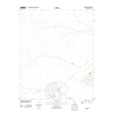
2012 Map of Fort Irwin
USGS Topo · Published 2012About this map
Fort Irwin serves as the central hub of this Mojave Desert landscape, characterized by its specialized military infrastructure and arid terrain. The settlement layout shows a dense network of streets and facilities situated south of the sprawling Coyote Canyon. To the east, the geography is defined by the significant dry lake bed of Bicycle Lake, which supports the Bicycle Lake Army Airfield. This 2012 survey by the U.S. Geological Survey captures the established footprint of the National Training Center, illustrating the relationship between the built military environment and the surrounding desert basins. The map provides a clear look at the logistical positioning of airfield operations relative to the primary cantonment area during the early 21st century.
Find a feature on this map
5 named features on this map. Tap any name to fly to it.
Don’t see what you’re looking for? This feature index may not catch every label — zoom into the map to look around manually.
Map Details
Editions of this 2012 Fort Irwin Map
This is the sole edition of this map. No revisions or reprints were ever made.
Other maps of this area

1933 · Avawatz Mountains
USGS Topo · 1:250,000

1947 · Trona
USGS Topo · 1:250,000

1948 · Trona
USGS Topo · 1:250,000

1948 · Alvord Mountain
USGS Topo · 1:62,500

1948 · Lane Mountain
USGS Topo · 1:62,500

1948 · Goldstone Lake
USGS Topo · 1:62,500

1948 · Tiefort Mountains
USGS Topo · 1:62,500

1951 · Goldstone Lake
USGS Topo · 1:62,500

1951 · Tiefort Mountains
USGS Topo · 1:62,500

1951 · Alvord Mountain
USGS Topo · 1:62,500