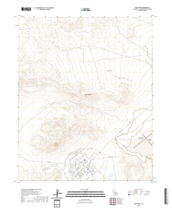
2021 Map of Fort Irwin
USGS Topo · Published 2021About this map
The Mojave Desert terrain dominates this military landscape, where the concentrated infrastructure of the base contrasts with the arid topography. At the heart of the developed area, a dense network of streets including Normandy Dr, Salerno Dr, and Alvord Dr serves the personnel and operations of the installation. This 2021 survey illustrates the modern layout of the base, centered around arterial routes like Fort Irwin Rd and Westbrook Ave. To the east, the Bicycle Lake Army Airfield is situated alongside the dry bed of Bicycle Lake, a critical operational feature of the desert training center. The surrounding landscape is defined by natural landforms such as Coyote Canyon, providing a clear record of how military planning has adapted to the distinct alluvial and mountainous elevations of the San Bernardino County desert.
Find a feature on this map
34 named features on this map. Tap any name to fly to it.
Don’t see what you’re looking for? This feature index may not catch every label — zoom into the map to look around manually.
Map Details
Editions of this 2021 Fort Irwin Map
This is the sole edition of this map. No revisions or reprints were ever made.
Other maps of this area

1933 · Avawatz Mountains
USGS Topo · 1:250,000

1947 · Trona
USGS Topo · 1:250,000

1948 · Trona
USGS Topo · 1:250,000

1948 · Alvord Mountain
USGS Topo · 1:62,500

1948 · Lane Mountain
USGS Topo · 1:62,500

1948 · Goldstone Lake
USGS Topo · 1:62,500

1948 · Tiefort Mountains
USGS Topo · 1:62,500

1951 · Goldstone Lake
USGS Topo · 1:62,500

1951 · Tiefort Mountains
USGS Topo · 1:62,500

1951 · Alvord Mountain
USGS Topo · 1:62,500