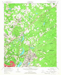
1953 Map of Fort Jackson North
USGS Topo · Published 1968About this map
Fort Jackson Military Reservation dominates the eastern half of this landscape, characterized by tactical roads like Rifles Road and Enon Road weaving through the training grounds. To the west, the mid-century growth of Columbia is evident in the residential expansion of Forest Acres and Kilbourn Park. A notable concentration of social and medical infrastructure appears near State Park, including the South Carolina Sanatorium, the State Hospital, and the Carolina Orphanage.
Find a feature on this map
93 named features on this map. Tap any name to fly to it.
Don’t see what you’re looking for? This feature index may not catch every label — zoom into the map to look around manually.
Map Details
Editions of this 1953 Fort Jackson North Map
2 editions found
Other maps of this area

1904 · Columbia
USGS Topo · 1:125,000

1935 · Killian
USGS Topo · 1:48,000

1937 · Killian
USGS Topo · 1:62,500

1941 · Spartanburg
USGS Topo · 1:250,000

1942 · Camden
USGS Topo · 1:125,000

1944 · Edmund
USGS Topo · 1:62,500

1947 · Columbia North
USGS Topo · 1:24,000

1948 · Hopkins
USGS Topo · 1:62,500

1948 · Columbia North
USGS Topo · 1:24,000

1949 · Irmo NE
USGS Topo · 1:24,000