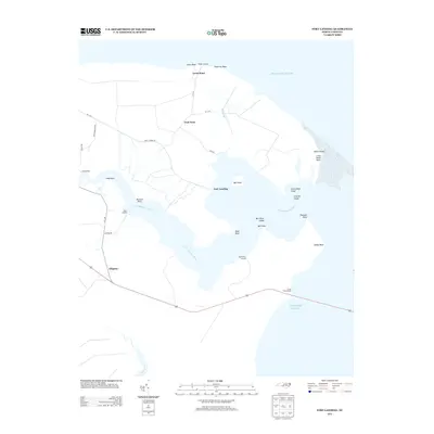
2013 Map of Fort Landing
USGS Topo · Published 2013About this map
Fort Landing sits at the heart of this coastal North Carolina landscape, where the Little Alligator River widens as it approaches the sound. The area is defined by a network of historic river access points, including Pledger Landing, Miller Landing, and Log Landing, reflecting the deep-seated maritime and timber heritage of Tyrrell County. These landings served as vital nodes for transport before modern road infrastructure became the primary means of movement through the low-lying terrain.
Find a feature on this map
36 named features on this map. Tap any name to fly to it.
Don’t see what you’re looking for? This feature index may not catch every label — zoom into the map to look around manually.
Map Details
Editions of this 2013 Fort Landing Map
This is the sole edition of this map. No revisions or reprints were ever made.
Other maps of this area

1940 · Powells Point
USGS Topo · 1:62,500

1940 · Wade Point
USGS Topo · 1:62,500

1943 · Wade Point
USGS Topo · 1:62,500

1943 · Columbia
USGS Topo · 1:125,000

1943 · Roanoke Island
USGS Topo · 1:125,000

1946 · Eastville
USGS Topo · 1:250,000

1946 · Currituck Sound
USGS Topo · 1:250,000

1948 · Wade Point
USGS Topo · 1:62,500

1953 · Norfolk
USGS Topo · 1:250,000

1953 · Buffalo City
USGS Topo · 1:24,000