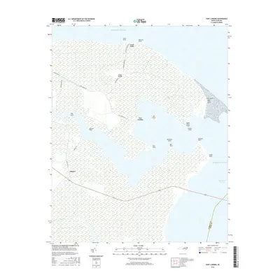
2016 Map of Fort Landing
USGS Topo · Published 2016About this map
The coastal marshes of Tyrrell County meet the Atlantic Ocean in this detailed 2016 survey of the Fort Landing area. This landscape is defined by its complex network of shoreline features and water-management history, from the Intracoastal Waterway cutting through the south to the small, scattered islands like Big Island, Goose Pond Island, and Charles Island. The map documents a sparsely settled region where human activity is concentrated along roads like Fort Landing Rd and Goat Neck Rd. Geographic landmarks such as Atkins Island Long Shoal Point and Mill Point Island illustrate the intricate, low-lying topography of the Inner Banks, while Greens Canal points to the long-standing efforts to drain and manage these vast wetlands for navigation or agricultural use. Small communities like Alligator and Goat Neck remain anchored to the few corridors of high ground that weave through the marsh.
Find a feature on this map
27 named features on this map. Tap any name to fly to it.
Don’t see what you’re looking for? This feature index may not catch every label — zoom into the map to look around manually.
Map Details
Editions of this 2016 Fort Landing Map
This is the sole edition of this map. No revisions or reprints were ever made.
Other maps of this area

1940 · Powells Point
USGS Topo · 1:62,500

1940 · Wade Point
USGS Topo · 1:62,500

1943 · Wade Point
USGS Topo · 1:62,500

1943 · Columbia
USGS Topo · 1:125,000

1943 · Roanoke Island
USGS Topo · 1:125,000

1946 · Eastville
USGS Topo · 1:250,000

1946 · Currituck Sound
USGS Topo · 1:250,000

1948 · Wade Point
USGS Topo · 1:62,500

1953 · Norfolk
USGS Topo · 1:250,000

1953 · Buffalo City
USGS Topo · 1:24,000